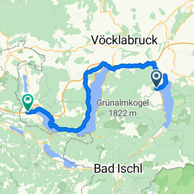
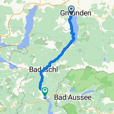
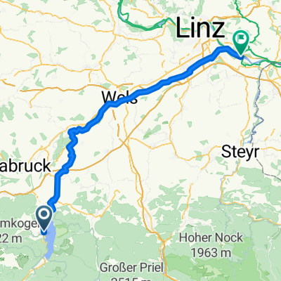
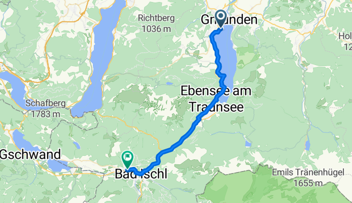
Doktor-Franz-Thomas-Straße 26e - Marie-Louisen-Straße
A cycling route starting in Altmünster, Upper Austria, Austria.
Overview
About this route
- 2 h 3 min
- Duration
- 34.4 km
- Distance
- 173 m
- Ascent
- 160 m
- Descent
- 16.7 km/h
- Avg. speed
- 488 m
- Max. altitude
Route photos
Route quality
Waytypes & surfaces along the route
Waytypes
Path
17 km
(49 %)
Road
7.8 km
(23 %)
Surfaces
Paved
25.9 km
(75 %)
Unpaved
1 km
(3 %)
Asphalt
25.7 km
(75 %)
Gravel
0.6 km
(2 %)
Continue with Bikemap
Use, edit, or download this cycling route
You would like to ride Doktor-Franz-Thomas-Straße 26e - Marie-Louisen-Straße or customize it for your own trip? Here is what you can do with this Bikemap route:
Free features
- Save this route as favorite or in collections
- Copy & plan your own version of this route
- Sync your route with Garmin or Wahoo
Premium features
Free trial for 3 days, or one-time payment. More about Bikemap Premium.
- Navigate this route on iOS & Android
- Export a GPX / KML file of this route
- Create your custom printout (try it for free)
- Download this route for offline navigation
Discover more Premium features.
Get Bikemap PremiumFrom our community
Other popular routes starting in Altmünster
- CCC2 - 4 Seen-Runde
- Distance
- 147.2 km
- Ascent
- 942 m
- Descent
- 940 m
- Location
- Altmünster, Upper Austria, Austria
- Gmundene
- Distance
- 42.3 km
- Ascent
- 580 m
- Descent
- 583 m
- Location
- Altmünster, Upper Austria, Austria
- Doktor-Franz-Thomas-Straße 26e - Marie-Louisen-Straße
- Distance
- 34.4 km
- Ascent
- 173 m
- Descent
- 160 m
- Location
- Altmünster, Upper Austria, Austria
- Gmundnerberg
- Distance
- 13.2 km
- Ascent
- 361 m
- Descent
- 360 m
- Location
- Altmünster, Upper Austria, Austria
- Home-Attersee-Home
- Distance
- 45.1 km
- Ascent
- 445 m
- Descent
- 312 m
- Location
- Altmünster, Upper Austria, Austria
- Traunsteinstraße 277, Gmunden nach Hoisnweg, Gmunden
- Distance
- 72 km
- Ascent
- 625 m
- Descent
- 617 m
- Location
- Altmünster, Upper Austria, Austria
- kal
- Distance
- 60.5 km
- Ascent
- 782 m
- Descent
- 822 m
- Location
- Altmünster, Upper Austria, Austria
- Gmunden- Taferlklausssee - Weyregg
- Distance
- 31.7 km
- Ascent
- 661 m
- Descent
- 612 m
- Location
- Altmünster, Upper Austria, Austria
Open it in the app