
Ventoux, Paname, part 2
Châtillon-Coligny, Cepoy
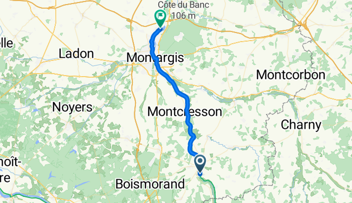
A cycling route starting in Châtillon-Coligny, Centre-Val de Loire, France.
Overview
About this route
Last Sunday, deep in the Nièvre between Bourbon-Lancy and Decize, a horrible route with climbs and descents, the heatwave, 25 km at a maximum of 15 km/h – even some climbs on foot + out of desperation I put on a podcast – it was the only time on the route – about the life of Jean Genet – a small but significant detail... I see from afar on the road and eventually overtake a man, in his thirties, shirtless, very tanned, barefoot, some random flip-flops, in shorts with a backpack and a basic MTB. I take off my headphones, say hello with eye contact. Empty stare, no response. OK... Handsome, wild looking face, goatee, blond hair tied in a bun. I ride 10 minutes ahead of him thinking I’m slowly distancing him. Mistake – the guy overtakes me on the first difficulty and speeds off. I keep him briefly in view but he eventually disappears. (On a climb I eat blackberries, I’m exhausted – but that doesn’t matter). I forget about the guy. Today, 5 days later, on the Loing, on the path around a bridge, downhill, I meet the same guy! EXACTLY THE SAME!!!!!! Same pose, same attitude, same response to my waving hello: NO REACTION – NOTHING!!!!! Of course, I turn my head to look at him longer. What a man! I’ll let you draw your own conclusions. We’ll talk later. I’m stoked...
- 1 h 52 min
- Duration
- 33 km
- Distance
- 100 m
- Ascent
- 146 m
- Descent
- 17.7 km/h
- Avg. speed
- 130 m
- Max. altitude

Part of
9 stages
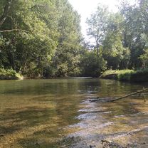
Route photos

Route quality
Waytypes & surfaces along the route
Waytypes
Cycleway
32 km
(97 %)
Quiet road
0.7 km
(2 %)
Access road
0.3 km
(1 %)
Surfaces
Paved
30.4 km
(92 %)
Asphalt
30.4 km
(92 %)
Undefined
2.6 km
(8 %)
Continue with Bikemap
Use, edit, or download this cycling route
You would like to ride Châtillon-Coligny, Cepoy or customize it for your own trip? Here is what you can do with this Bikemap route:
Free features
- Save this route as favorite or in collections
- Copy & plan your own version of this route
- Sync your route with Garmin or Wahoo
Premium features
Free trial for 3 days, or one-time payment. More about Bikemap Premium.
- Navigate this route on iOS & Android
- Export a GPX / KML file of this route
- Create your custom printout (try it for free)
- Download this route for offline navigation
Discover more Premium features.
Get Bikemap PremiumFrom our community
Other popular routes starting in Châtillon-Coligny
 Châtillon-Coligny, Cepoy
- Distance
- 33 km
- Ascent
- 100 m
- Descent
- 146 m
- Location
- Châtillon-Coligny, Centre-Val de Loire, France
 Tag 11 - BT - Chatillon-Coligny - Sully-sur-Loire
- Distance
- 70.2 km
- Ascent
- 322 m
- Descent
- 329 m
- Location
- Châtillon-Coligny, Centre-Val de Loire, France
 Chemin des Écorces, Châtillon-Coligny à 14 Grande Rue, Vimory
- Distance
- 20.7 km
- Ascent
- 60 m
- Descent
- 96 m
- Location
- Châtillon-Coligny, Centre-Val de Loire, France
 Canal de Briare 3
- Distance
- 22.8 km
- Ascent
- 55 m
- Descent
- 55 m
- Location
- Châtillon-Coligny, Centre-Val de Loire, France
 De Le Clos de la Chapelle 9, La Chapelle-sur-Aveyron à Le Clos de la Chapelle 9, La Chapelle-sur-Aveyron
- Distance
- 18.2 km
- Ascent
- 150 m
- Descent
- 194 m
- Location
- Châtillon-Coligny, Centre-Val de Loire, France
 De Lotissement le Clos de la Chapelle 3, La Chapelle-sur-Aveyron à Lotissement le Clos de la Chapelle 3, La Chapelle-sur-Aveyron
- Distance
- 3.2 km
- Ascent
- 13 m
- Descent
- 21 m
- Location
- Châtillon-Coligny, Centre-Val de Loire, France
 FR18-01
- Distance
- 31.1 km
- Ascent
- 139 m
- Descent
- 133 m
- Location
- Châtillon-Coligny, Centre-Val de Loire, France
 De Rue de Condé 17, Châtillon-Coligny à Rue de la Lancière 42, Sainte-Geneviève-des-Bois
- Distance
- 12.8 km
- Ascent
- 282 m
- Descent
- 334 m
- Location
- Châtillon-Coligny, Centre-Val de Loire, France
Open it in the app