
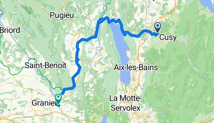
De D63 à Zone Artisanale du Contin
A cycling route starting in Cusy, Auvergne-Rhône-Alpes, France.
Overview
About this route
- 27 h 35 min
- Duration
- 79.4 km
- Distance
- 706 m
- Ascent
- 1,123 m
- Descent
- 2.9 km/h
- Avg. speed
- 739 m
- Max. altitude

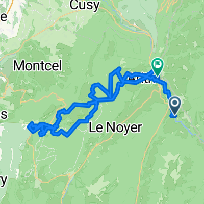
Route photos


Route quality
Waytypes & surfaces along the route
Waytypes
Access road
34.5 km
(44 %)
Quiet road
13.7 km
(17 %)
Surfaces
Paved
32.4 km
(41 %)
Unpaved
8.5 km
(11 %)
Asphalt
32.4 km
(41 %)
Gravel
8.4 km
(11 %)
Continue with Bikemap
Use, edit, or download this cycling route
You would like to ride De D63 à Zone Artisanale du Contin or customize it for your own trip? Here is what you can do with this Bikemap route:
Free features
- Save this route as favorite or in collections
- Copy & plan your own version of this route
- Sync your route with Garmin or Wahoo
Premium features
Free trial for 3 days, or one-time payment. More about Bikemap Premium.
- Navigate this route on iOS & Android
- Export a GPX / KML file of this route
- Create your custom printout (try it for free)
- Download this route for offline navigation
Discover more Premium features.
Get Bikemap PremiumFrom our community
Other popular routes starting in Cusy
 Val de Fier - Col du Chat
- Distance
- 97.3 km
- Ascent
- 879 m
- Descent
- 879 m
- Location
- Cusy, Auvergne-Rhône-Alpes, France
 De D63 à Zone Artisanale du Contin
- Distance
- 79.4 km
- Ascent
- 706 m
- Descent
- 1,123 m
- Location
- Cusy, Auvergne-Rhône-Alpes, France
 Col du Sapenay - Le Grand Colombier - Col de la Chambotte
- Distance
- 104.3 km
- Ascent
- 2,455 m
- Descent
- 2,455 m
- Location
- Cusy, Auvergne-Rhône-Alpes, France
 Parcour VTT au dessus de cusy
- Distance
- 21.3 km
- Ascent
- 1,001 m
- Descent
- 1,001 m
- Location
- Cusy, Auvergne-Rhône-Alpes, France
 etape 8
- Distance
- 105.1 km
- Ascent
- 891 m
- Descent
- 732 m
- Location
- Cusy, Auvergne-Rhône-Alpes, France
 southern half of the etape
- Distance
- 80.4 km
- Ascent
- 1,710 m
- Descent
- 1,711 m
- Location
- Cusy, Auvergne-Rhône-Alpes, France
 Arith Revard
- Distance
- 42.4 km
- Ascent
- 1,426 m
- Descent
- 1,454 m
- Location
- Cusy, Auvergne-Rhône-Alpes, France
 Le Semnoz (Crêt de Chatillon) par Quintal
- Distance
- 63.9 km
- Ascent
- 1,390 m
- Descent
- 1,390 m
- Location
- Cusy, Auvergne-Rhône-Alpes, France
Open it in the app