
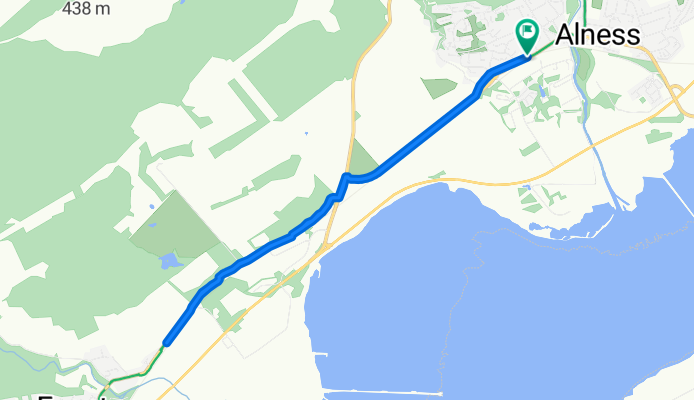
Teaninich Street to Teaninich Street
A cycling route starting in Alness, Scotland, United Kingdom.
Overview
About this route
- 46 min
- Duration
- 9.9 km
- Distance
- 56 m
- Ascent
- 115 m
- Descent
- 12.7 km/h
- Avg. speed
- 76 m
- Max. altitude
Dorota Dytmer
created this 3 months ago
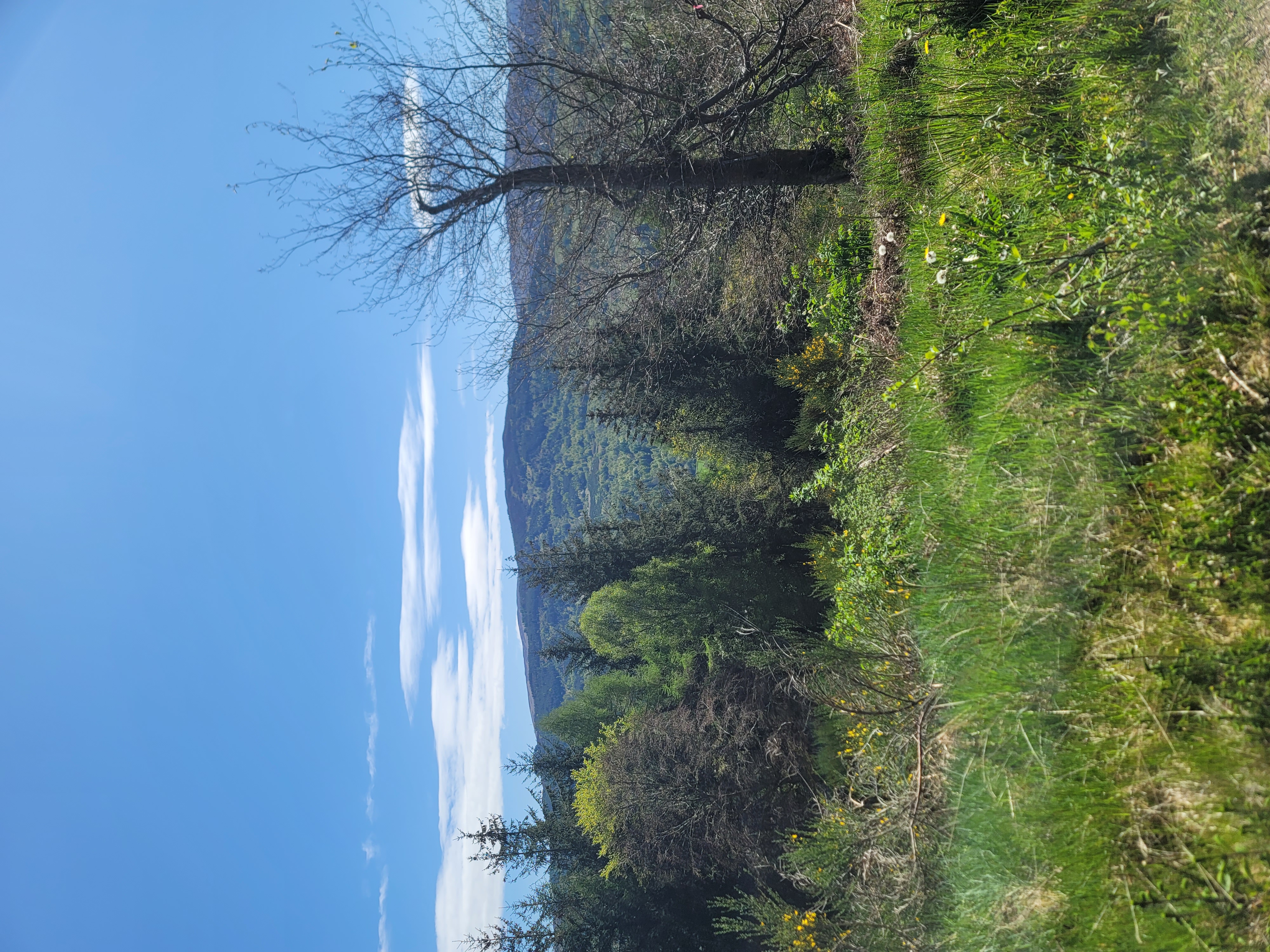
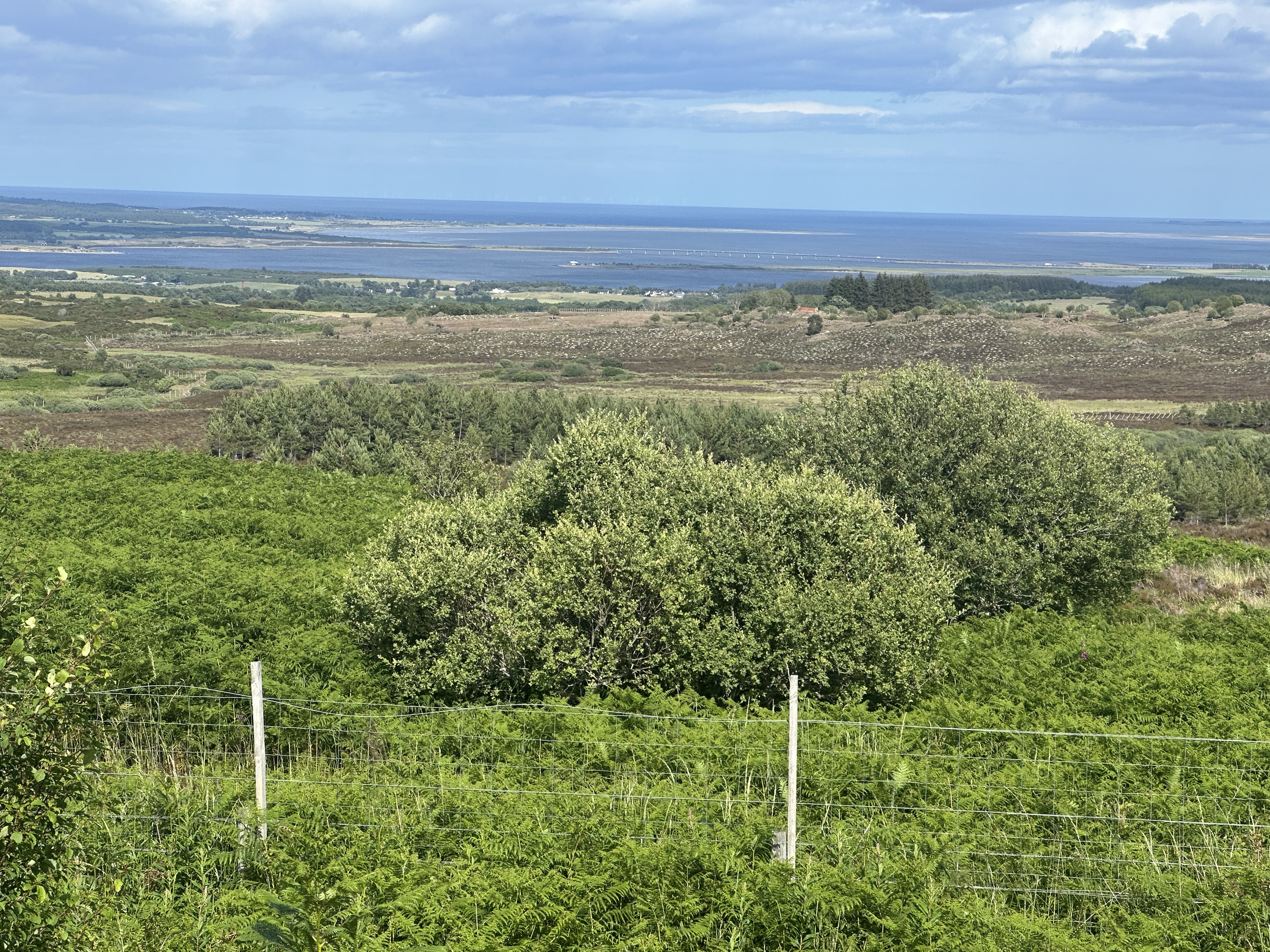
Route photos

Route quality
Waytypes & surfaces along the route
Waytypes
Cycleway
6.4 km
(65 %)
Quiet road
1 km
(10 %)
Undefined
2.5 km
(25 %)
Surfaces
Paved
0.1 km
(1 %)
Asphalt
0.1 km
(1 %)
Undefined
9.8 km
(99 %)
Continue with Bikemap
Use, edit, or download this cycling route
You would like to ride Teaninich Street to Teaninich Street or customize it for your own trip? Here is what you can do with this Bikemap route:
Free features
- Save this route as favorite or in collections
- Copy & plan your own version of this route
- Sync your route with Garmin or Wahoo
Premium features
Free trial for 3 days, or one-time payment. More about Bikemap Premium.
- Navigate this route on iOS & Android
- Export a GPX / KML file of this route
- Create your custom printout (try it for free)
- Download this route for offline navigation
Discover more Premium features.
Get Bikemap PremiumFrom our community
Other popular routes starting in Alness
- Invergordon Alternative
- 24.8 km
- 319 m
- 315 m
- Alness, Scotland, United Kingdom
- Shillinghill 125 to Farm Road End
- 10.8 km
- 91 m
- 39 m
- Alness, Scotland, United Kingdom
- River Lane 13 to Cromarty Drive 4, Kildary
- 16.9 km
- 161 m
- 157 m
- Alness, Scotland, United Kingdom
- High Street, Alness to Tigh-an-Daraich, Ardgay
- 27.5 km
- 281 m
- 293 m
- Alness, Scotland, United Kingdom
- B817 to Teaninich Avenue 2
- 10 km
- 42 m
- 36 m
- Alness, Scotland, United Kingdom
- Tarbat peninsula 2
- 112 km
- 701 m
- 696 m
- Alness, Scotland, United Kingdom
- Shillinghill 117 to Shillinghill 117
- 15.3 km
- 36 m
- 94 m
- Alness, Scotland, United Kingdom


Open it in the app