
From Paris to Couloumé-Mondebat
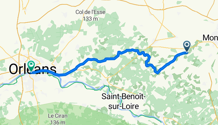
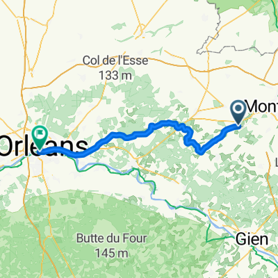
Chevillon-sur-Huillard - Orléans
A cycling route starting in Chevillon-sur-Huillard, Centre Region, France.
Overview
About this route
- 8 h 28 min
- Duration
- 66.3 km
- Distance
- 163 m
- Ascent
- 164 m
- Descent
- 7.8 km/h
- Avg. speed
- 137 m
- Max. altitude
Part of
From Paris to Couloumé-Mondebat
13 stages
Route quality
Waytypes & surfaces along the route
Waytypes
Cycleway
27.7 km
(42 %)
Path
22.3 km
(34 %)
Surfaces
Paved
24 km
(36 %)
Unpaved
33.2 km
(50 %)
Asphalt
23.2 km
(35 %)
Sand
22.1 km
(33 %)
Continue with Bikemap
Use, edit, or download this cycling route
You would like to ride Chevillon-sur-Huillard - Orléans or customize it for your own trip? Here is what you can do with this Bikemap route:
Free features
- Save this route as favorite or in collections
- Copy & plan your own version of this route
- Sync your route with Garmin or Wahoo
Premium features
Free trial for 3 days, or one-time payment. More about Bikemap Premium.
- Navigate this route on iOS & Android
- Export a GPX / KML file of this route
- Create your custom printout (try it for free)
- Download this route for offline navigation
Discover more Premium features.
Get Bikemap PremiumFrom our community
Other popular routes starting in Chevillon-sur-Huillard
 De Le May, Chevillon-sur-Huillard à 30 Grande Rue, Châteauneuf-sur-Loire
- Distance
- 45.9 km
- Ascent
- 136 m
- Descent
- 116 m
- Location
- Chevillon-sur-Huillard, Centre Region, France
 Chevillon-sur-Huillard - Orléans
- Distance
- 66.3 km
- Ascent
- 163 m
- Descent
- 164 m
- Location
- Chevillon-sur-Huillard, Centre Region, France
 De Les Ferandières, La Cour-Marigny à Les Ferandières, La Cour-Marigny
- Distance
- 3.3 km
- Ascent
- 113 m
- Descent
- 117 m
- Location
- Chevillon-sur-Huillard, Centre Region, France
 chevillon-sur-huillard / samois-sur-seine
- Distance
- 74.6 km
- Ascent
- 67 m
- Descent
- 114 m
- Location
- Chevillon-sur-Huillard, Centre Region, France
 De Route de Lorris, Presnoy à 1–11 Le Bois aux Juments, Villemoutiers
- Distance
- 8.9 km
- Ascent
- 112 m
- Descent
- 111 m
- Location
- Chevillon-sur-Huillard, Centre Region, France
 De 197bis Route de Montargis, Chevillon-sur-Huillard à 41 Rue des Églantines, Noyers
- Distance
- 13.5 km
- Ascent
- 47 m
- Descent
- 22 m
- Location
- Chevillon-sur-Huillard, Centre Region, France
 Chevillon 18km
- Distance
- 17.7 km
- Ascent
- 72 m
- Descent
- 71 m
- Location
- Chevillon-sur-Huillard, Centre Region, France
 De Les Ferandières, La Cour-Marigny à Les Ferandières, La Cour-Marigny
- Distance
- 9.6 km
- Ascent
- 64 m
- Descent
- 111 m
- Location
- Chevillon-sur-Huillard, Centre Region, France
Open it in the app