
From Paris to Couloumé-Mondebat
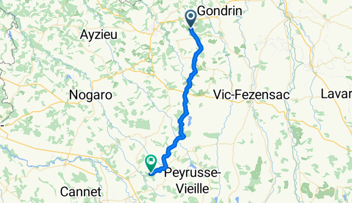
Gondrin - Plaisance
A cycling route starting in Gondrin, Occitanie, France.
Overview
About this route
- 2 h 3 min
- Duration
- 33 km
- Distance
- 479 m
- Ascent
- 455 m
- Descent
- 16.1 km/h
- Avg. speed
- 239 m
- Max. altitude
Part of
From Paris to Couloumé-Mondebat
13 stages
Route quality
Waytypes & surfaces along the route
Waytypes
Road
17.1 km
(52 %)
Quiet road
12.9 km
(39 %)
Track
3 km
(9 %)
Surfaces
Paved
18.1 km
(55 %)
Unpaved
1 km
(3 %)
Asphalt
18.1 km
(55 %)
Ground
1 km
(3 %)
Undefined
13.8 km
(42 %)
Continue with Bikemap
Use, edit, or download this cycling route
You would like to ride Gondrin - Plaisance or customize it for your own trip? Here is what you can do with this Bikemap route:
Free features
- Save this route as favorite or in collections
- Copy & plan your own version of this route
- Sync your route with Garmin or Wahoo
Premium features
Free trial for 3 days, or one-time payment. More about Bikemap Premium.
- Navigate this route on iOS & Android
- Export a GPX / KML file of this route
- Create your custom printout (try it for free)
- Download this route for offline navigation
Discover more Premium features.
Get Bikemap PremiumFrom our community
Other popular routes starting in Gondrin
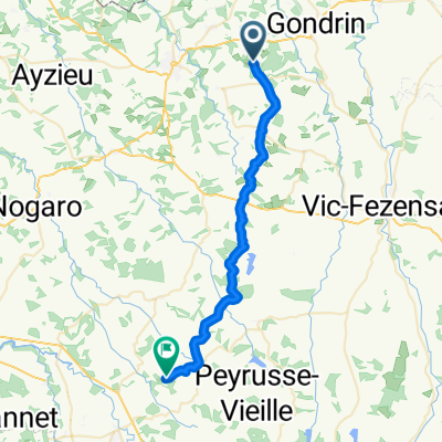 Gondrin - Plaisance
- Distance
- 33 km
- Ascent
- 479 m
- Descent
- 455 m
- Location
- Gondrin, Occitanie, France
 Brouquere1
- Distance
- 13.2 km
- Ascent
- 159 m
- Descent
- 161 m
- Location
- Gondrin, Occitanie, France
 Restful route in Lagraulet-du-Gers
- Distance
- 8.6 km
- Ascent
- 193 m
- Descent
- 190 m
- Location
- Gondrin, Occitanie, France
 Gondrin - Plaisance
- Distance
- 33 km
- Ascent
- 479 m
- Descent
- 455 m
- Location
- Gondrin, Occitanie, France
 De D158, Courrensan à Route de Castelnau d'Auzan, Bretagne-d'Armagnac
- Distance
- 8 km
- Ascent
- 89 m
- Descent
- 100 m
- Location
- Gondrin, Occitanie, France
 De D254, Lagraulet-du-Gers à 10 Rue du Maréchal Foch, Condom
- Distance
- 19.6 km
- Ascent
- 170 m
- Descent
- 212 m
- Location
- Gondrin, Occitanie, France
 Route van D208, Mouchan
- Distance
- 48.1 km
- Ascent
- 793 m
- Descent
- 729 m
- Location
- Gondrin, Occitanie, France
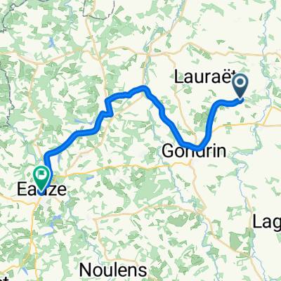 Chemin de Cambos, Lauraët nach Place d'Armagnac, Eauze
- Distance
- 25 km
- Ascent
- 256 m
- Descent
- 199 m
- Location
- Gondrin, Occitanie, France
Open it in the app