


Rundweg02
- 34.2 km
- 464 m
- 415 m
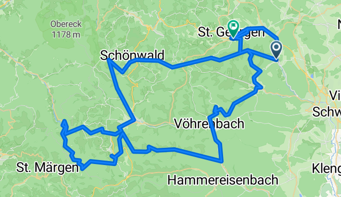
- Mönchweiler, Baden-Wurttemberg, Germany
A cycling route starting in Mönchweiler, Baden-Wurttemberg, Germany.
Overview
Very beautiful tour starting in Schonach. Nicely evenly ascending, well-developed road through the Stockwald valley towards Schönwald. From Schönwald then on the German Clock Road to Furtwangen. Further on the Clock Road towards Gütenbach, where just after the town exit one of the most beautiful downhill sections begins, with nicely developed curves. Approximately halfway between Gütenbach and Obersimonswald, turn left into the romantic Wildgutach valley. Here too, a well-developed, evenly ascending downhill ride with an intermediate destination at 'Hexenlochmühle'. The mill is located in the gorge-like Hexenloch, sometimes also called the Hexenloch valley. It is the only mill in the Black Forest with two water wheels. In 1825, the part with the smaller water wheel was built as a nail smithy. Later, the part with the larger water wheel was added as a sawmill. Finally, the part with the smaller water wheel was converted into a workshop for clock frame making. The large water wheel of the mill has a diameter of 4 m, through which approximately 300 liters of water flow per second. It has a power of up to 13 HP. It still powers two saws, but only for demonstration purposes; no actual sawing is done anymore. The Hexenlochmühle is one of the most popular photographic motifs in the Black Forest.
created this 4 months ago

Route quality
Road
37.6 km
(38 %)
Quiet road
29.7 km
(30 %)
Paved
84.1 km
(85 %)
Unpaved
1 km
(1 %)
Asphalt
78.1 km
(79 %)
Paved (undefined)
5.9 km
(6 %)
Continue with Bikemap
You would like to ride Schwarzwald St.Georgen-Hexenloch or customize it for your own trip? Here is what you can do with this Bikemap route:
Free trial for 3 days, or one-time payment. More about Bikemap Premium.
Discover more Premium features.
Get Bikemap PremiumFrom our community
Open it in the app


