
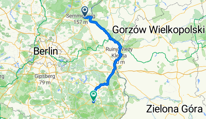
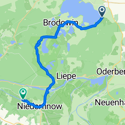
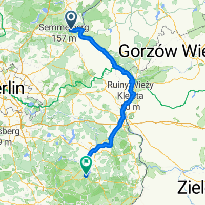
Route nach Goyatz
A cycling route starting in Oderberg, Brandenburg, Germany.
Overview
About this route
- 9 h 13 min
- Duration
- 155.2 km
- Distance
- 399 m
- Ascent
- 359 m
- Descent
- 16.9 km/h
- Avg. speed
- 97 m
- Max. altitude
Route quality
Waytypes & surfaces along the route
Waytypes
Path
65.2 km
(42 %)
Track
32.6 km
(21 %)
Surfaces
Paved
131.9 km
(85 %)
Unpaved
1.6 km
(1 %)
Asphalt
127.3 km
(82 %)
Paved (undefined)
4.7 km
(3 %)
Continue with Bikemap
Use, edit, or download this cycling route
You would like to ride Route nach Goyatz or customize it for your own trip? Here is what you can do with this Bikemap route:
Free features
- Save this route as favorite or in collections
- Copy & plan your own version of this route
- Split it into stages to create a multi-day tour
- Sync your route with Garmin or Wahoo
Premium features
Free trial for 3 days, or one-time payment. More about Bikemap Premium.
- Navigate this route on iOS & Android
- Export a GPX / KML file of this route
- Create your custom printout (try it for free)
- Download this route for offline navigation
Discover more Premium features.
Get Bikemap PremiumFrom our community
Other popular routes starting in Oderberg
 Oderstraße, Bad Freienwalde do Pod Zodiakiem, Kołbaskowo
- Distance
- 83.3 km
- Ascent
- 197 m
- Descent
- 184 m
- Location
- Oderberg, Brandenburg, Germany
 Von Oderberg nach Frankfurt/Oder
- Distance
- 105.9 km
- Ascent
- 254 m
- Descent
- 244 m
- Location
- Oderberg, Brandenburg, Germany
 19 I Abkürzung Parstein - Niederfinow
- Distance
- 20.4 km
- Ascent
- 155 m
- Descent
- 192 m
- Location
- Oderberg, Brandenburg, Germany
 Runde um das Schiffshebewerk Niederfinow 2012-07-08
- Distance
- 69.4 km
- Ascent
- 258 m
- Descent
- 261 m
- Location
- Oderberg, Brandenburg, Germany
 Route nach Goyatz
- Distance
- 155.2 km
- Ascent
- 399 m
- Descent
- 359 m
- Location
- Oderberg, Brandenburg, Germany
 Parstein nach Dorfstraße
- Distance
- 25.3 km
- Ascent
- 255 m
- Descent
- 329 m
- Location
- Oderberg, Brandenburg, Germany
 19 I Abkürzung Parstein - Niederfinow
- Distance
- 20.2 km
- Ascent
- 150 m
- Descent
- 187 m
- Location
- Oderberg, Brandenburg, Germany
 Hohenwutzener Chaussee, Bad Freienwalde nach Poststraße, Letschin
- Distance
- 28.2 km
- Ascent
- 17 m
- Descent
- 17 m
- Location
- Oderberg, Brandenburg, Germany
Open it in the app