
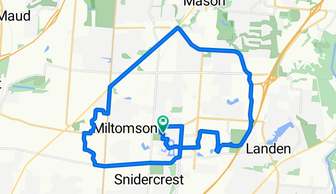
Mason South 24km
A cycling route starting in Highpoint, Ohio, United States.
Overview
About this route
- 1 h 23 min
- Duration
- 24.1 km
- Distance
- 124 m
- Ascent
- 124 m
- Descent
- 17.5 km/h
- Avg. speed
- 295 m
- Max. altitude
Route quality
Waytypes & surfaces along the route
Waytypes
Cycleway
7.8 km
(32 %)
Quiet road
6.4 km
(26 %)
Surfaces
Paved
2.3 km
(9 %)
Asphalt
2.2 km
(9 %)
Concrete
0.1 km
(<1 %)
Undefined
21.8 km
(91 %)
Continue with Bikemap
Use, edit, or download this cycling route
You would like to ride Mason South 24km or customize it for your own trip? Here is what you can do with this Bikemap route:
Free features
- Save this route as favorite or in collections
- Copy & plan your own version of this route
- Sync your route with Garmin or Wahoo
Premium features
Free trial for 3 days, or one-time payment. More about Bikemap Premium.
- Navigate this route on iOS & Android
- Export a GPX / KML file of this route
- Create your custom printout (try it for free)
- Download this route for offline navigation
Discover more Premium features.
Get Bikemap PremiumFrom our community
Other popular routes starting in Highpoint
 Rob2Church
- Distance
- 12.9 km
- Ascent
- 41 m
- Descent
- 86 m
- Location
- Highpoint, Ohio, United States
 Easy ride in West Chester
- Distance
- 14.6 km
- Ascent
- 119 m
- Descent
- 120 m
- Location
- Highpoint, Ohio, United States
 6621 Lewisclark Trail, Cincinnati to 6621 Lewisclark Trail, Cincinnati
- Distance
- 12.5 km
- Ascent
- 49 m
- Descent
- 51 m
- Location
- Highpoint, Ohio, United States
 Rob2Forts
- Distance
- 5.7 km
- Ascent
- 13 m
- Descent
- 21 m
- Location
- Highpoint, Ohio, United States
 5700–5936 Squires Gate Dr, Mason to 6621 Lewisclark Trail, Cincinnati
- Distance
- 5.8 km
- Ascent
- 29 m
- Descent
- 25 m
- Location
- Highpoint, Ohio, United States
 5933 Timber Rail Ln, Mason to 5933 Timber Rail Ln, Mason
- Distance
- 10.1 km
- Ascent
- 41 m
- Descent
- 41 m
- Location
- Highpoint, Ohio, United States
 9902 Meadow Hills Dr, West Chester to 301–399 Thomas Dr, Springboro
- Distance
- 51.5 km
- Ascent
- 336 m
- Descent
- 318 m
- Location
- Highpoint, Ohio, United States
 7394 W Chester Rd, West Chester to 8715 Rupp Farm Dr, West Chester
- Distance
- 5.1 km
- Ascent
- 23 m
- Descent
- 89 m
- Location
- Highpoint, Ohio, United States
Open it in the app