
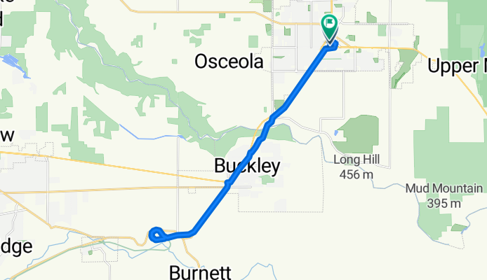
Enumclaw to closed Spikton Ditch Bridge, Foothills Trail; return
A cycling route starting in Enumclaw, Washington, United States.
Overview
About this route
- 1 h 40 min
- Duration
- 22.1 km
- Distance
- 132 m
- Ascent
- 107 m
- Descent
- 13.3 km/h
- Avg. speed
- 230 m
- Max. altitude

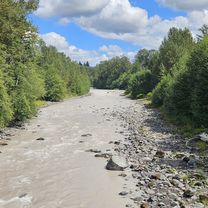
Route photos


Continue with Bikemap
Use, edit, or download this cycling route
You would like to ride Enumclaw to closed Spikton Ditch Bridge, Foothills Trail; return or customize it for your own trip? Here is what you can do with this Bikemap route:
Free features
- Save this route as favorite or in collections
- Copy & plan your own version of this route
- Sync your route with Garmin or Wahoo
Premium features
Free trial for 3 days, or one-time payment. More about Bikemap Premium.
- Navigate this route on iOS & Android
- Export a GPX / KML file of this route
- Create your custom printout (try it for free)
- Download this route for offline navigation
Discover more Premium features.
Get Bikemap PremiumFrom our community
Other popular routes starting in Enumclaw
 Enumclaw Cycling
- Distance
- 89.1 km
- Ascent
- 605 m
- Descent
- 603 m
- Location
- Enumclaw, Washington, United States
 Enumclaw to closed Spikton Ditch Bridge, Foothills Trail; return
- Distance
- 22.1 km
- Ascent
- 132 m
- Descent
- 107 m
- Location
- Enumclaw, Washington, United States
 Enumclaw to Yakima
- Distance
- 195.6 km
- Ascent
- 2,032 m
- Descent
- 1,927 m
- Location
- Enumclaw, Washington, United States
 RamRod Course CLONED FROM ROUTE 251030
- Distance
- 257.6 km
- Ascent
- 2,411 m
- Descent
- 2,387 m
- Location
- Enumclaw, Washington, United States
 Career route
- Distance
- 30.2 km
- Ascent
- 85 m
- Descent
- 107 m
- Location
- Enumclaw, Washington, United States
 Around Rainier4
- Distance
- 313.8 km
- Ascent
- 3,004 m
- Descent
- 3,007 m
- Location
- Enumclaw, Washington, United States
 RAMROD 2014
- Distance
- 267.5 km
- Ascent
- 2,170 m
- Descent
- 2,170 m
- Location
- Enumclaw, Washington, United States
 Enum to green water
- Distance
- 31 km
- Ascent
- 520 m
- Descent
- 213 m
- Location
- Enumclaw, Washington, United States
Open it in the app