
Paseo lento
A cycling route starting in San Agustín, Jalisco, Mexico.
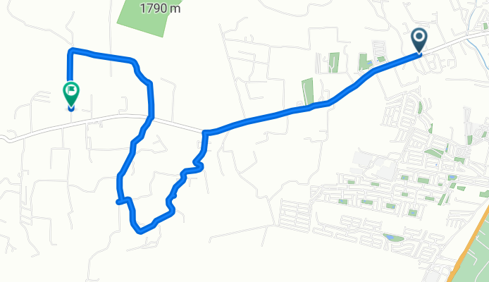
Overview
About this route
- 55 min
- Duration
- 8.2 km
- Distance
- 162 m
- Ascent
- 76 m
- Descent
- 9 km/h
- Avg. speed
- 1,708 m
- Max. altitude
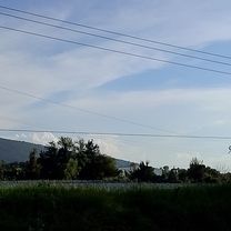
Route photos


Route quality
Waytypes & surfaces along the route
Waytypes
Quiet road
5.6 km
(68 %)
Road
2.6 km
(32 %)
Undefined
-0 km
(<1 %)
Surfaces
Paved
1.8 km
(22 %)
Asphalt
1.8 km
(22 %)
Undefined
6.4 km
(78 %)
Continue with Bikemap
Use, edit, or download this cycling route
You would like to ride Paseo lento or customize it for your own trip? Here is what you can do with this Bikemap route:
Free features
- Save this route as favorite or in collections
- Copy & plan your own version of this route
- Sync your route with Garmin or Wahoo
Premium features
Free trial for 3 days, or one-time payment. More about Bikemap Premium.
- Navigate this route on iOS & Android
- Export a GPX / KML file of this route
- Create your custom printout (try it for free)
- Download this route for offline navigation
Discover more Premium features.
Get Bikemap PremiumFrom our community
Other popular routes starting in San Agustín
 Camino Real de Colima 3018, Tlajomulco de Zúñiga to Calle Cedro 29, Tlajomulco de Zúñiga
- Distance
- 10.8 km
- Ascent
- 74 m
- Descent
- 80 m
- Location
- San Agustín, Jalisco, Mexico
 Recovered Route
- Distance
- 19.5 km
- Ascent
- 196 m
- Descent
- 192 m
- Location
- San Agustín, Jalisco, Mexico
 Paseo lento
- Distance
- 8.2 km
- Ascent
- 162 m
- Descent
- 76 m
- Location
- San Agustín, Jalisco, Mexico
 Torre 1 y descenso Mago de Oz
- Distance
- 20.7 km
- Ascent
- 623 m
- Descent
- 614 m
- Location
- San Agustín, Jalisco, Mexico
 Torre 1
- Distance
- 19.4 km
- Ascent
- 568 m
- Descent
- 567 m
- Location
- San Agustín, Jalisco, Mexico
 tronadora/mago de oz
- Distance
- 21.2 km
- Ascent
- 646 m
- Descent
- 641 m
- Location
- San Agustín, Jalisco, Mexico
 Recovered Route
- Distance
- 24 km
- Ascent
- 251 m
- Descent
- 255 m
- Location
- San Agustín, Jalisco, Mexico
 De Avenida Vuelo de las Grullas a Calle López Cotilla 7B
- Distance
- 6.7 km
- Ascent
- 101 m
- Descent
- 102 m
- Location
- San Agustín, Jalisco, Mexico
Open it in the app