
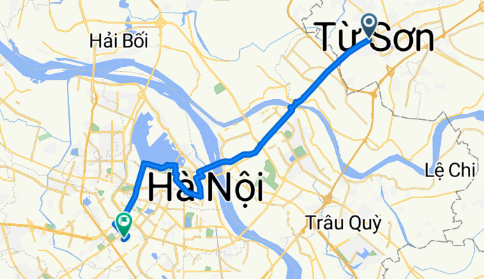
Trần Phú, TP. Từ Sơn to Ngụy Như Kon Tum, Hà Nội
A cycling route starting in Lim, Bắc Ninh Province, Vietnam.
Overview
About this route
- 2 h 16 min
- Duration
- 28.2 km
- Distance
- 201 m
- Ascent
- 200 m
- Descent
- 12.4 km/h
- Avg. speed
- 29 m
- Max. altitude

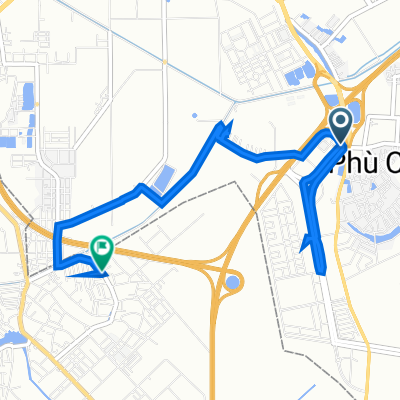
Route photos


Continue with Bikemap
Use, edit, or download this cycling route
You would like to ride Trần Phú, TP. Từ Sơn to Ngụy Như Kon Tum, Hà Nội or customize it for your own trip? Here is what you can do with this Bikemap route:
Free features
- Save this route as favorite or in collections
- Copy & plan your own version of this route
- Sync your route with Garmin or Wahoo
Premium features
Free trial for 3 days, or one-time payment. More about Bikemap Premium.
- Navigate this route on iOS & Android
- Export a GPX / KML file of this route
- Create your custom printout (try it for free)
- Download this route for offline navigation
Discover more Premium features.
Get Bikemap PremiumFrom our community
Other popular routes starting in Lim
 yes sir
- Distance
- 33.8 km
- Ascent
- 109 m
- Descent
- 102 m
- Location
- Lim, Bắc Ninh Province, Vietnam
 Trần Phú, TP. Từ Sơn to Ngụy Như Kon Tum, Hà Nội
- Distance
- 28.2 km
- Ascent
- 201 m
- Descent
- 200 m
- Location
- Lim, Bắc Ninh Province, Vietnam
 ko biet
- Distance
- 31.2 km
- Ascent
- 103 m
- Descent
- 100 m
- Location
- Lim, Bắc Ninh Province, Vietnam
 Lý Thái Tổ, Thị xã Từ Sơn to Đường Nguyễn Văn Cừ, Thị xã Từ Sơn
- Distance
- 2.9 km
- Ascent
- 14 m
- Descent
- 20 m
- Location
- Lim, Bắc Ninh Province, Vietnam
 4XF3+2RV, Từ Sơn to Đường Ngô Gia Tự 1077
- Distance
- 8.4 km
- Ascent
- 22 m
- Descent
- 17 m
- Location
- Lim, Bắc Ninh Province, Vietnam
 Hữu Nghị, TP. Từ Sơn to X. Ninh Hiệp, Hà Nội
- Distance
- 7.1 km
- Ascent
- 9 m
- Descent
- 6 m
- Location
- Lim, Bắc Ninh Province, Vietnam
 X. Đại Đồng, H. Tiên Du to X. Đại Đồng, H. Tiên Du
- Distance
- 9.9 km
- Ascent
- 7 m
- Descent
- 3 m
- Location
- Lim, Bắc Ninh Province, Vietnam
Open it in the app