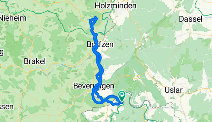
Gerhart-Hauptmann-Weg nach Gerhart-Hauptmann-Weg
A cycling route starting in Bad Karlshafen, Lower Saxony, Germany.
Overview
About this route
- 3 h 45 min
- Duration
- 62.4 km
- Distance
- 615 m
- Ascent
- 617 m
- Descent
- 16.7 km/h
- Avg. speed
- 288 m
- Max. altitude
Route quality
Waytypes & surfaces along the route
Waytypes
Track
23.7 km
(38 %)
Quiet road
17.5 km
(28 %)
Surfaces
Paved
48.1 km
(77 %)
Unpaved
3.7 km
(6 %)
Asphalt
46.8 km
(75 %)
Gravel
3.7 km
(6 %)
Continue with Bikemap
Use, edit, or download this cycling route
You would like to ride Gerhart-Hauptmann-Weg nach Gerhart-Hauptmann-Weg or customize it for your own trip? Here is what you can do with this Bikemap route:
Free features
- Save this route as favorite or in collections
- Copy & plan your own version of this route
- Sync your route with Garmin or Wahoo
Premium features
Free trial for 3 days, or one-time payment. More about Bikemap Premium.
- Navigate this route on iOS & Android
- Export a GPX / KML file of this route
- Create your custom printout (try it for free)
- Download this route for offline navigation
Discover more Premium features.
Get Bikemap PremiumFrom our community
Other popular routes starting in Bad Karlshafen
Gerhart-Hauptmann-Weg nach Gerhart-Hauptmann-Weg- Distance
- 62.4 km
- Ascent
- 615 m
- Descent
- 617 m
- Location
- Bad Karlshafen, Lower Saxony, Germany
Gerhart-Hauptmann-Weg nach Trendelburg- Distance
- 28.1 km
- Ascent
- 263 m
- Descent
- 226 m
- Location
- Bad Karlshafen, Lower Saxony, Germany
9KarlshafenHannMB- Distance
- 51.1 km
- Ascent
- 338 m
- Descent
- 301 m
- Location
- Bad Karlshafen, Lower Saxony, Germany
BadKarlshafen-Hameln- Distance
- 93.9 km
- Ascent
- 127 m
- Descent
- 160 m
- Location
- Bad Karlshafen, Lower Saxony, Germany
tuor 2- Distance
- 83.4 km
- Ascent
- 339 m
- Descent
- 370 m
- Location
- Bad Karlshafen, Lower Saxony, Germany
Mückenhohlweg nach Mückenhohlweg- Distance
- 47.8 km
- Ascent
- 514 m
- Descent
- 541 m
- Location
- Bad Karlshafen, Lower Saxony, Germany
Feierabendrunde mit Spaßfaktor- Distance
- 18 km
- Ascent
- 374 m
- Descent
- 365 m
- Location
- Bad Karlshafen, Lower Saxony, Germany
An der Schlagd 3, Карлсхафен до An der Schlagd 3, Карлсхафен- Distance
- 53.1 km
- Ascent
- 930 m
- Descent
- 931 m
- Location
- Bad Karlshafen, Lower Saxony, Germany
Open it in the app


