

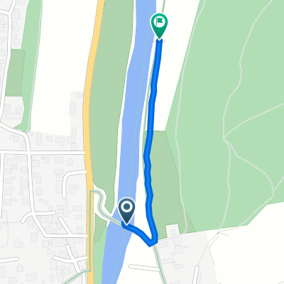
Naabtal-Regental durch Schwaighauser Forst
A cycling route starting in Duggendorf, Bavaria, Germany.
Overview
About this route
Mountain bike tour, mainly following the marked hiking trails
At the endpoint in the Regental valley, return by the same route until the turnoff to Unterkaulhausen
- -:--
- Duration
- 30.3 km
- Distance
- 545 m
- Ascent
- 540 m
- Descent
- ---
- Avg. speed
- ---
- Max. altitude
Route highlights
Points of interest along the route
Point of interest after 6.9 km
Abzweig Rückweg nach Unterkaulhausen
Point of interest after 15.1 km
Vereinsheim Bogenschützen (Pause) - Umkehren, gleiche Strecke zurück bis Abzweig nach Schwaighausen
Continue with Bikemap
Use, edit, or download this cycling route
You would like to ride Naabtal-Regental durch Schwaighauser Forst or customize it for your own trip? Here is what you can do with this Bikemap route:
Free features
- Save this route as favorite or in collections
- Copy & plan your own version of this route
- Sync your route with Garmin or Wahoo
Premium features
Free trial for 3 days, or one-time payment. More about Bikemap Premium.
- Navigate this route on iOS & Android
- Export a GPX / KML file of this route
- Create your custom printout (try it for free)
- Download this route for offline navigation
Discover more Premium features.
Get Bikemap PremiumFrom our community
Other popular routes starting in Duggendorf
 Tour Duggendorf Etterzhausen Nittendorf
- Distance
- 31 km
- Ascent
- 571 m
- Descent
- 476 m
- Location
- Duggendorf, Bavaria, Germany
 Talstraße 1, Duggendorf nach Duggendorf
- Distance
- 0.5 km
- Ascent
- 3 m
- Descent
- 8 m
- Location
- Duggendorf, Bavaria, Germany
 Naab-Donaurunde
- Distance
- 105 km
- Ascent
- 576 m
- Descent
- 576 m
- Location
- Duggendorf, Bavaria, Germany
 Naabtal-Regental durch Schwaighauser Forst
- Distance
- 30.3 km
- Ascent
- 545 m
- Descent
- 540 m
- Location
- Duggendorf, Bavaria, Germany
 neuhof-brunn
- Distance
- 18.6 km
- Ascent
- 253 m
- Descent
- 234 m
- Location
- Duggendorf, Bavaria, Germany
 Oberpfalz1
- Distance
- 109.4 km
- Ascent
- 556 m
- Descent
- 557 m
- Location
- Duggendorf, Bavaria, Germany
 Runde 1 um den Übungsplatz
- Distance
- 102.1 km
- Ascent
- 535 m
- Descent
- 544 m
- Location
- Duggendorf, Bavaria, Germany
 Naabtal-Labertal-Runde
- Distance
- 65.2 km
- Ascent
- 456 m
- Descent
- 458 m
- Location
- Duggendorf, Bavaria, Germany
Open it in the app