

Um den Flughafen
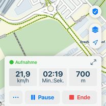
- 33 km
- 160 m
- 160 m
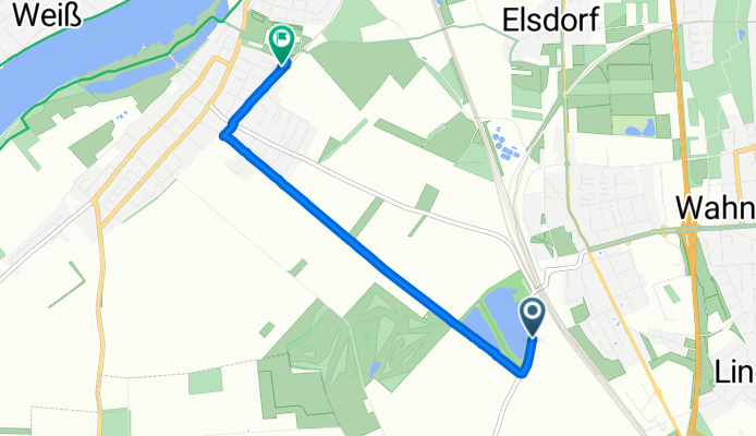
- Wahn-Heide, North Rhine-Westphalia, Germany
A cycling route starting in Wahn-Heide, North Rhine-Westphalia, Germany.
Overview
created this 3 months ago


Route quality
Track
2.3 km
(53 %)
Path
1 km
(23 %)
Paved
3.8 km
(87 %)
Asphalt
3.8 km
(87 %)
Undefined
0.6 km
(13 %)
Continue with Bikemap
You would like to ride Liburer Landstraße, Köln nach Dahlienweg, Köln or customize it for your own trip? Here is what you can do with this Bikemap route:
Free trial for 3 days, or one-time payment. More about Bikemap Premium.
Discover more Premium features.
Get Bikemap PremiumFrom our community
Open it in the app