
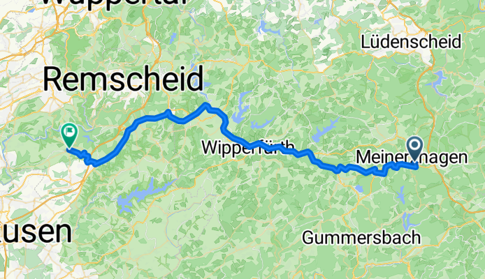
Hochstraße, Meinerzhagen nach Solinger Straße, Leichlingen (Rheinland)
A cycling route starting in Meinerzhagen, North Rhine-Westphalia, Germany.
Overview
About this route
- 2 h 51 min
- Duration
- 52.3 km
- Distance
- 612 m
- Ascent
- 805 m
- Descent
- 18.3 km/h
- Avg. speed
- 481 m
- Max. altitude
Route quality
Waytypes & surfaces along the route
Waytypes
Cycleway
21.1 km
(40 %)
Path
16.1 km
(31 %)
Surfaces
Paved
42.7 km
(82 %)
Unpaved
2.3 km
(4 %)
Asphalt
40.8 km
(78 %)
Gravel
2.3 km
(4 %)
Continue with Bikemap
Use, edit, or download this cycling route
You would like to ride Hochstraße, Meinerzhagen nach Solinger Straße, Leichlingen (Rheinland) or customize it for your own trip? Here is what you can do with this Bikemap route:
Free features
- Save this route as favorite or in collections
- Copy & plan your own version of this route
- Sync your route with Garmin or Wahoo
Premium features
Free trial for 3 days, or one-time payment. More about Bikemap Premium.
- Navigate this route on iOS & Android
- Export a GPX / KML file of this route
- Create your custom printout (try it for free)
- Download this route for offline navigation
Discover more Premium features.
Get Bikemap PremiumFrom our community
Other popular routes starting in Meinerzhagen
 Die Aggertour
- Distance
- 26.2 km
- Ascent
- 414 m
- Descent
- 415 m
- Location
- Meinerzhagen, North Rhine-Westphalia, Germany
 Listerquelle nach Roscheid und zurück 30km
- Distance
- 30.5 km
- Ascent
- 450 m
- Descent
- 442 m
- Location
- Meinerzhagen, North Rhine-Westphalia, Germany
 20100808 Meinerzhagen
- Distance
- 25.2 km
- Ascent
- 531 m
- Descent
- 520 m
- Location
- Meinerzhagen, North Rhine-Westphalia, Germany
 Hitzendumicke
- Distance
- 48.5 km
- Ascent
- 599 m
- Descent
- 602 m
- Location
- Meinerzhagen, North Rhine-Westphalia, Germany
 Radtour Nordhelle Aschluss 2009
- Distance
- 52.1 km
- Ascent
- 627 m
- Descent
- 627 m
- Location
- Meinerzhagen, North Rhine-Westphalia, Germany
 Aggertrip
- Distance
- 49.6 km
- Ascent
- 126 m
- Descent
- 426 m
- Location
- Meinerzhagen, North Rhine-Westphalia, Germany
 Von OCEANLINE Watersporteqiment zur Listertalsperre bis zum Biggedamm
- Distance
- 45.9 km
- Ascent
- 612 m
- Descent
- 614 m
- Location
- Meinerzhagen, North Rhine-Westphalia, Germany
 Periple 11 / 35
- Distance
- 195.2 km
- Ascent
- 1,285 m
- Descent
- 1,476 m
- Location
- Meinerzhagen, North Rhine-Westphalia, Germany
Open it in the app