
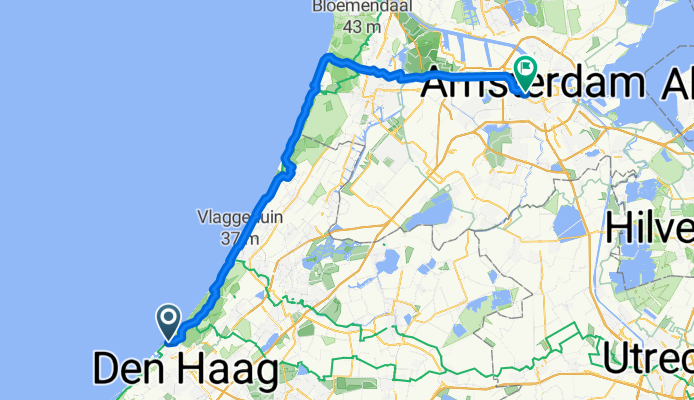
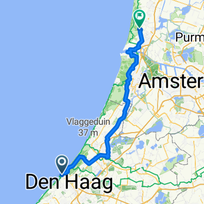
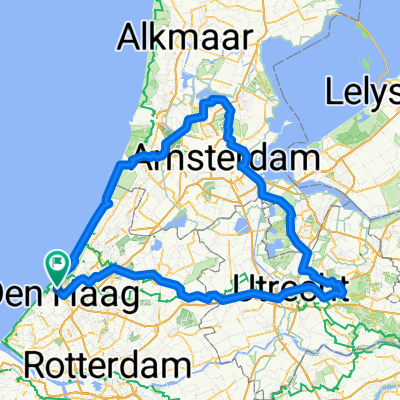
Gevers Deynootweg, La Haya a Leidsekade, Ámsterdam
A cycling route starting in Scheveningen, South Holland, The Netherlands.
Overview
About this route
- 6 h 18 min
- Duration
- 70.6 km
- Distance
- 227 m
- Ascent
- 259 m
- Descent
- 11.2 km/h
- Avg. speed
- 53 m
- Max. altitude

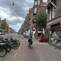
Route photos


Route quality
Waytypes & surfaces along the route
Waytypes
Cycleway
58.6 km
(83 %)
Quiet road
6.4 km
(9 %)
Surfaces
Paved
52.9 km
(75 %)
Asphalt
50.1 km
(71 %)
Paved (undefined)
2.1 km
(3 %)
Continue with Bikemap
Use, edit, or download this cycling route
You would like to ride Gevers Deynootweg, La Haya a Leidsekade, Ámsterdam or customize it for your own trip? Here is what you can do with this Bikemap route:
Free features
- Save this route as favorite or in collections
- Copy & plan your own version of this route
- Sync your route with Garmin or Wahoo
Premium features
Free trial for 3 days, or one-time payment. More about Bikemap Premium.
- Navigate this route on iOS & Android
- Export a GPX / KML file of this route
- Create your custom printout (try it for free)
- Download this route for offline navigation
Discover more Premium features.
Get Bikemap PremiumFrom our community
Other popular routes starting in Scheveningen
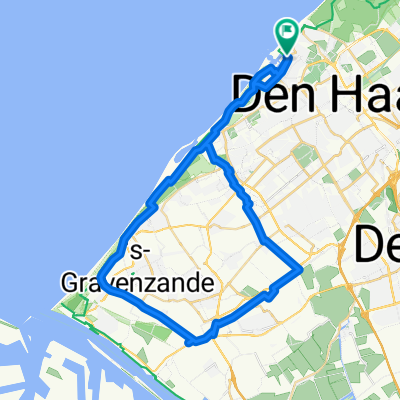
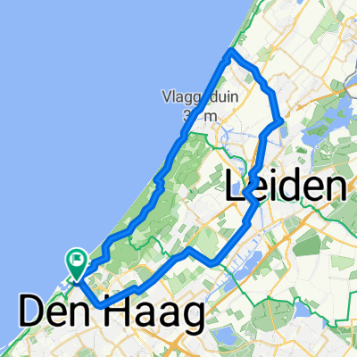 Noordwijk / Leiden
- Distance
- 55 km
- Ascent
- 30 m
- Descent
- 32 m
- Location
- Scheveningen, South Holland, The Netherlands
 Gevers Deynootweg, La Haya a Leidsekade, Ámsterdam
- Distance
- 70.6 km
- Ascent
- 227 m
- Descent
- 259 m
- Location
- Scheveningen, South Holland, The Netherlands
 Haag - Noordwij
- Distance
- 25.7 km
- Ascent
- 73 m
- Descent
- 69 m
- Location
- Scheveningen, South Holland, The Netherlands
 Rotterdam - Amsterdam
- Distance
- 81 km
- Ascent
- 215 m
- Descent
- 212 m
- Location
- Scheveningen, South Holland, The Netherlands
 Raid velo
- Distance
- 239.1 km
- Ascent
- 361 m
- Descent
- 361 m
- Location
- Scheveningen, South Holland, The Netherlands
 Pompstationsweg 353, Den Haag nach Boulevard Zeezijde 17, Katwijk aan Zee
- Distance
- 11.8 km
- Ascent
- 62 m
- Descent
- 59 m
- Location
- Scheveningen, South Holland, The Netherlands
 Rondje Westland
- Distance
- 47.3 km
- Ascent
- 45 m
- Descent
- 43 m
- Location
- Scheveningen, South Holland, The Netherlands
 Badhuisstraat 164, Den Haag nach Hoek van Hollandlaan 20, Den Haag
- Distance
- 7.2 km
- Ascent
- 61 m
- Descent
- 58 m
- Location
- Scheveningen, South Holland, The Netherlands
Open it in the app