
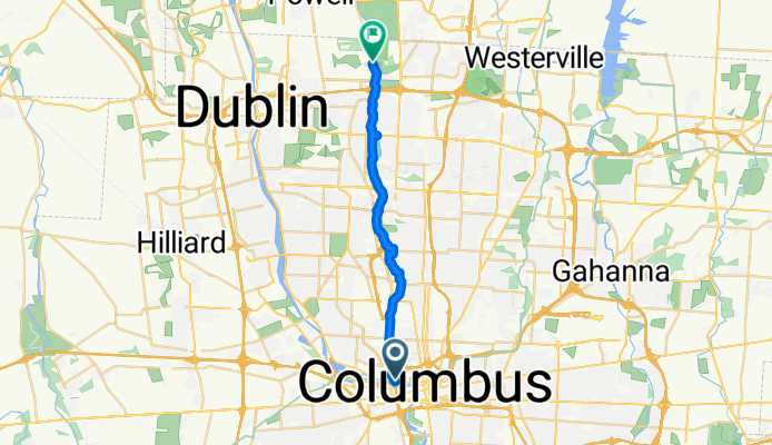
Olentangy trail
A cycling route starting in Columbus, Ohio, United States.
Overview
About this route
- 56 min
- Duration
- 21.6 km
- Distance
- 73 m
- Ascent
- 63 m
- Descent
- 23.1 km/h
- Avg. speed
- 237 m
- Max. altitude
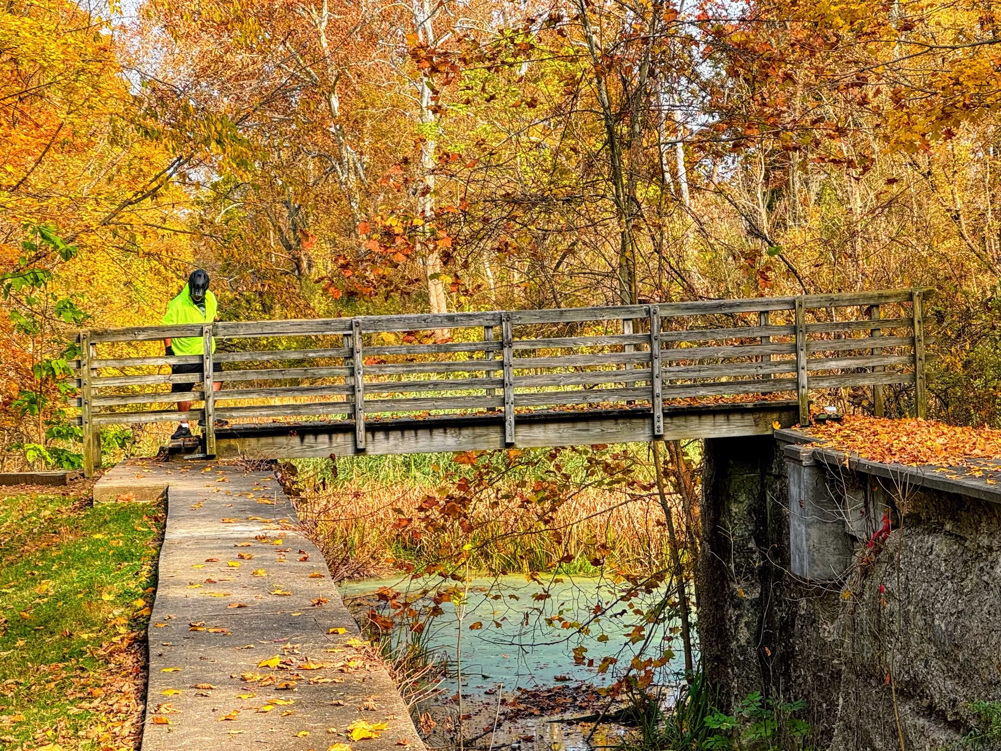
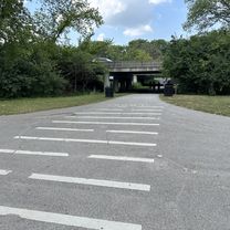
Route photos


Route quality
Waytypes & surfaces along the route
Waytypes
Cycleway
17.5 km
(81 %)
Path
2.7 km
(13 %)
Surfaces
Paved
15.4 km
(71 %)
Unpaved
0.1 km
(<1 %)
Asphalt
15.4 km
(71 %)
Ground
0.1 km
(<1 %)
Undefined
6.1 km
(28 %)
Continue with Bikemap
Use, edit, or download this cycling route
You would like to ride Olentangy trail or customize it for your own trip? Here is what you can do with this Bikemap route:
Free features
- Save this route as favorite or in collections
- Copy & plan your own version of this route
- Sync your route with Garmin or Wahoo
Premium features
Free trial for 3 days, or one-time payment. More about Bikemap Premium.
- Navigate this route on iOS & Android
- Export a GPX / KML file of this route
- Create your custom printout (try it for free)
- Download this route for offline navigation
Discover more Premium features.
Get Bikemap PremiumFrom our community
Other popular routes starting in Columbus
 S High St, Columbus to Stelzer Rd, Columbus
- Distance
- 12.7 km
- Ascent
- 341 m
- Descent
- 324 m
- Location
- Columbus, Ohio, United States
 Mills Park Hotel, Yellow Springs
- Distance
- 88.8 km
- Ascent
- 355 m
- Descent
- 295 m
- Location
- Columbus, Ohio, United States
 Olentangy trail
- Distance
- 21.6 km
- Ascent
- 73 m
- Descent
- 63 m
- Location
- Columbus, Ohio, United States
 102 W Broad St, Columbus to 6 N Washington St, Millersburg
- Distance
- 148.3 km
- Ascent
- 774 m
- Descent
- 724 m
- Location
- Columbus, Ohio, United States
 Columbus_Xenia_OTE
- Distance
- 92.8 km
- Ascent
- 196 m
- Descent
- 132 m
- Location
- Columbus, Ohio, United States
 Schumacher Place
- Distance
- 6.5 km
- Ascent
- 336 m
- Descent
- 351 m
- Location
- Columbus, Ohio, United States
 Dowtown Stroll to Courthouse and Scioto
- Distance
- 13.1 km
- Ascent
- 58 m
- Descent
- 56 m
- Location
- Columbus, Ohio, United States
 404 Brodbelt Ln, Columbus to 671 S Sixth St, Columbus
- Distance
- 6.3 km
- Ascent
- 29 m
- Descent
- 24 m
- Location
- Columbus, Ohio, United States
Open it in the app