
Ekkehard-Hauer-Straße nach Burgplatz
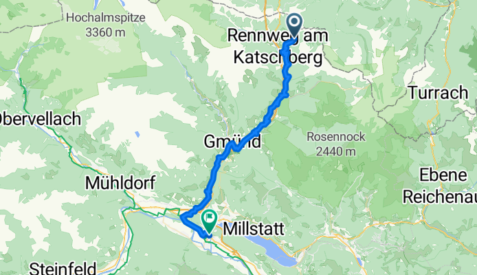
Sankt Margarethen im Lungau - Spittal an der Drau
A cycling route starting in Sankt Margarethen im Lungau, Salzburg, Austria.
Overview
About this route
- 3 h 9 min
- Duration
- 46.6 km
- Distance
- 1,559 m
- Ascent
- 2,485 m
- Descent
- 14.8 km/h
- Avg. speed
- 1,491 m
- Max. altitude

Part of
Route quality
Waytypes & surfaces along the route
Waytypes
Track
12.6 km
(27 %)
Quiet road
11.2 km
(24 %)
Surfaces
Paved
15.4 km
(33 %)
Unpaved
4.2 km
(9 %)
Asphalt
14.9 km
(32 %)
Gravel
2.8 km
(6 %)
Continue with Bikemap
Use, edit, or download this cycling route
You would like to ride Sankt Margarethen im Lungau - Spittal an der Drau or customize it for your own trip? Here is what you can do with this Bikemap route:
Free features
- Save this route as favorite or in collections
- Copy & plan your own version of this route
- Sync your route with Garmin or Wahoo
Premium features
Free trial for 3 days, or one-time payment. More about Bikemap Premium.
- Navigate this route on iOS & Android
- Export a GPX / KML file of this route
- Create your custom printout (try it for free)
- Download this route for offline navigation
Discover more Premium features.
Get Bikemap PremiumFrom our community
Other popular routes starting in Sankt Margarethen im Lungau
 St. Michael-Aussee
- Distance
- 119 km
- Ascent
- 2,469 m
- Descent
- 2,837 m
- Location
- Sankt Margarethen im Lungau, Salzburg, Austria
 6_St. Margarethen im Lungau Rundkurs
- Distance
- 84.1 km
- Ascent
- 1,549 m
- Descent
- 1,550 m
- Location
- Sankt Margarethen im Lungau, Salzburg, Austria
 Männerausflug 2015 Tag3
- Distance
- 40.7 km
- Ascent
- 1,173 m
- Descent
- 1,702 m
- Location
- Sankt Margarethen im Lungau, Salzburg, Austria
 Illmitzen-Radtsadt
- Distance
- 48.3 km
- Ascent
- 796 m
- Descent
- 999 m
- Location
- Sankt Margarethen im Lungau, Salzburg, Austria
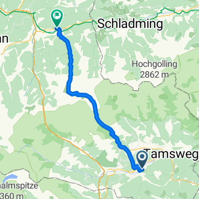
 Schulgasse .76, Sankt Margarethen im Lungau nach Hans-Schmid-Straße 12, Tamsweg
- Distance
- 12.4 km
- Ascent
- 12 m
- Descent
- 55 m
- Location
- Sankt Margarethen im Lungau, Salzburg, Austria
 Lungau - Nockberge
- Distance
- 54.9 km
- Ascent
- 1,398 m
- Descent
- 1,397 m
- Location
- Sankt Margarethen im Lungau, Salzburg, Austria
 Straße ohne Straßennamen nach Ablanzergasse 85, Sankt Martin
- Distance
- 22.4 km
- Ascent
- 906 m
- Descent
- 868 m
- Location
- Sankt Margarethen im Lungau, Salzburg, Austria
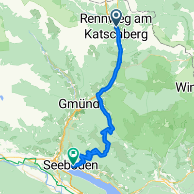
 Stage4_Rennweg_Tamsweg_Murau
- Distance
- 70.1 km
- Ascent
- 1,022 m
- Descent
- 1,353 m
- Location
- Sankt Margarethen im Lungau, Salzburg, Austria
Open it in the app