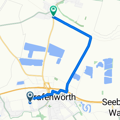
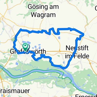
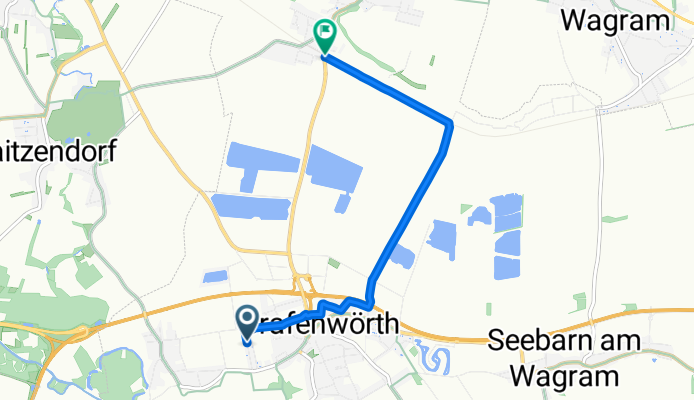
Kirchwegsiedlung nach Wagram-Grafenegg
A cycling route starting in Grafenwörth, Lower Austria, Austria.
Overview
About this route
- 19 min
- Duration
- 5.6 km
- Distance
- 6 m
- Ascent
- 4 m
- Descent
- 17.7 km/h
- Avg. speed
- 191 m
- Max. altitude
Route quality
Waytypes & surfaces along the route
Waytypes
Quiet road
3.9 km
(71 %)
Track
1.5 km
(27 %)
Undefined
0.1 km
(2 %)
Surfaces
Paved
3.4 km
(62 %)
Paved (undefined)
3.2 km
(58 %)
Asphalt
0.2 km
(4 %)
Undefined
2.1 km
(38 %)
Continue with Bikemap
Use, edit, or download this cycling route
You would like to ride Kirchwegsiedlung nach Wagram-Grafenegg or customize it for your own trip? Here is what you can do with this Bikemap route:
Free features
- Save this route as favorite or in collections
- Copy & plan your own version of this route
- Sync your route with Garmin or Wahoo
Premium features
Free trial for 3 days, or one-time payment. More about Bikemap Premium.
- Navigate this route on iOS & Android
- Export a GPX / KML file of this route
- Create your custom printout (try it for free)
- Download this route for offline navigation
Discover more Premium features.
Get Bikemap PremiumFrom our community
Other popular routes starting in Grafenwörth
Shillig schöne Strecke Krems - Hernals, Wien- Distance
- 68.6 km
- Ascent
- 351 m
- Descent
- 342 m
- Location
- Grafenwörth, Lower Austria, Austria
Donautour Grafenwörth- Distance
- 37.8 km
- Ascent
- 124 m
- Descent
- 123 m
- Location
- Grafenwörth, Lower Austria, Austria
Wagram Tour- Distance
- 72.8 km
- Ascent
- 244 m
- Descent
- 239 m
- Location
- Grafenwörth, Lower Austria, Austria
Traisen Donau- Distance
- 45.5 km
- Ascent
- 194 m
- Descent
- 194 m
- Location
- Grafenwörth, Lower Austria, Austria
L113, Grafenwörth nach Wiener Straße, Tulln an der Donau- Distance
- 53 km
- Ascent
- 269 m
- Descent
- 278 m
- Location
- Grafenwörth, Lower Austria, Austria
20120531 - Donauradweg 5- Distance
- 67.1 km
- Ascent
- 68 m
- Descent
- 92 m
- Location
- Grafenwörth, Lower Austria, Austria
Kirchwegsiedlung nach Wagram-Grafenegg- Distance
- 5.6 km
- Ascent
- 6 m
- Descent
- 4 m
- Location
- Grafenwörth, Lower Austria, Austria
*7. nap Grafenwörth-Grafenegg-Langenlois-Theiss-Krems- Distance
- 52.1 km
- Ascent
- 99 m
- Descent
- 80 m
- Location
- Grafenwörth, Lower Austria, Austria
Open it in the app


