
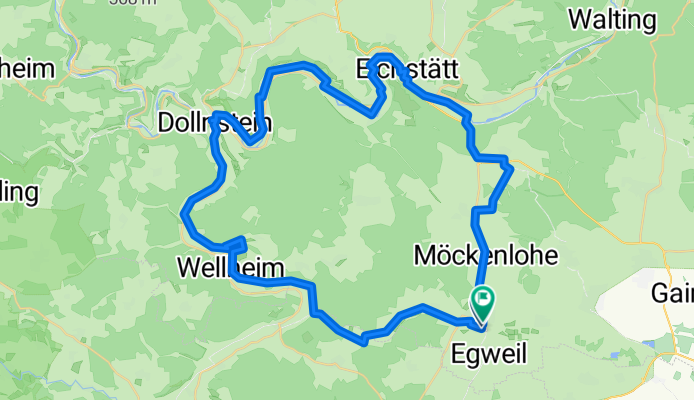
Radrunde auf dem GeoRadweg Altmühltal Route 3 von Nassenfels über Wellheim, Dollnstein und Eichstätt
A cycling route starting in Egweil, Bavaria, Germany.
Overview
About this route
- 3 h 29 min
- Duration
- 56 km
- Distance
- 237 m
- Ascent
- 236 m
- Descent
- 16.1 km/h
- Avg. speed
- 477 m
- Max. altitude
Continue with Bikemap
Use, edit, or download this cycling route
You would like to ride Radrunde auf dem GeoRadweg Altmühltal Route 3 von Nassenfels über Wellheim, Dollnstein und Eichstätt or customize it for your own trip? Here is what you can do with this Bikemap route:
Free features
- Save this route as favorite or in collections
- Copy & plan your own version of this route
- Sync your route with Garmin or Wahoo
Premium features
Free trial for 3 days, or one-time payment. More about Bikemap Premium.
- Navigate this route on iOS & Android
- Export a GPX / KML file of this route
- Create your custom printout (try it for free)
- Download this route for offline navigation
Discover more Premium features.
Get Bikemap PremiumFrom our community
Other popular routes starting in Egweil
 Nassenfels
- Distance
- 6.8 km
- Ascent
- 80 m
- Descent
- 80 m
- Location
- Egweil, Bavaria, Germany
 Rennrad-Bergroute Egweil 1, 42km
- Distance
- 40.6 km
- Ascent
- 444 m
- Descent
- 444 m
- Location
- Egweil, Bavaria, Germany
 Nassenfels
- Distance
- 6.7 km
- Ascent
- 76 m
- Descent
- 79 m
- Location
- Egweil, Bavaria, Germany
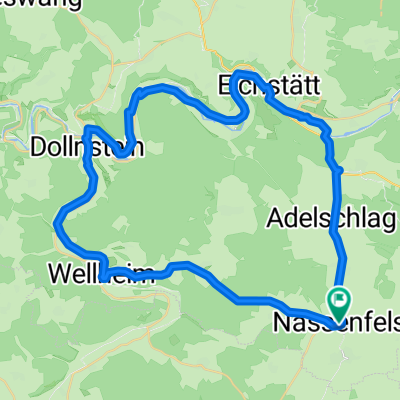 Nassenfels-Adelschlag-Eichstätt-Dollnstein-Wellheim-Nassenfels
- Distance
- 48.6 km
- Ascent
- 319 m
- Descent
- 319 m
- Location
- Egweil, Bavaria, Germany
 50 min GA1 flach
- Distance
- 26.2 km
- Ascent
- 83 m
- Descent
- 87 m
- Location
- Egweil, Bavaria, Germany
 Moderate Route in Egweil
- Distance
- 16 km
- Ascent
- 108 m
- Descent
- 104 m
- Location
- Egweil, Bavaria, Germany
 70 km in 3,07 h
- Distance
- 70.2 km
- Ascent
- 162 m
- Descent
- 162 m
- Location
- Egweil, Bavaria, Germany
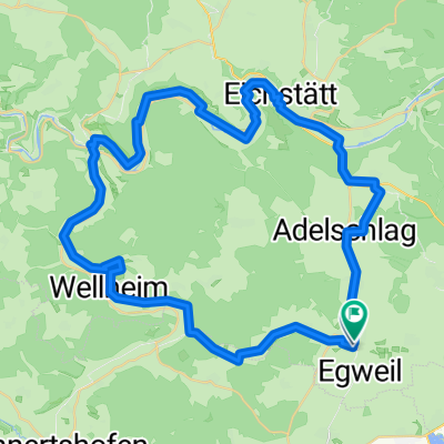 Radrunde auf dem GeoRadweg Altmühltal Route 3 von Nassenfels über Wellheim, Dollnstein und Eichstätt
- Distance
- 56 km
- Ascent
- 237 m
- Descent
- 236 m
- Location
- Egweil, Bavaria, Germany
Open it in the app