
day 2 of otet
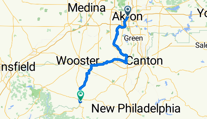
A cycling route starting in Akron, Ohio, United States.
Overview
About this route
- 7 h 57 min
- Duration
- 114.7 km
- Distance
- 477 m
- Ascent
- 505 m
- Descent
- 14.4 km/h
- Avg. speed
- 366 m
- Max. altitude
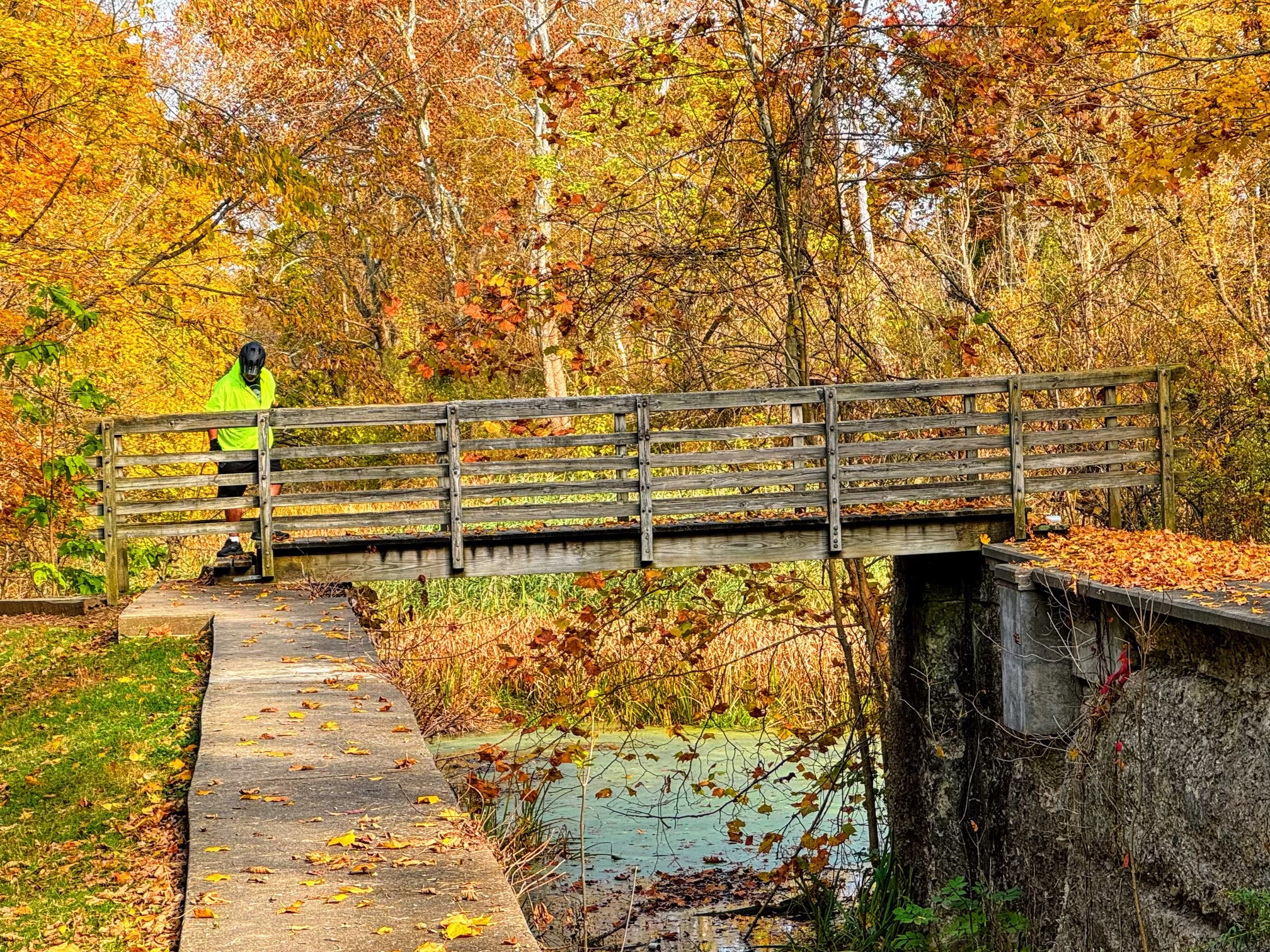
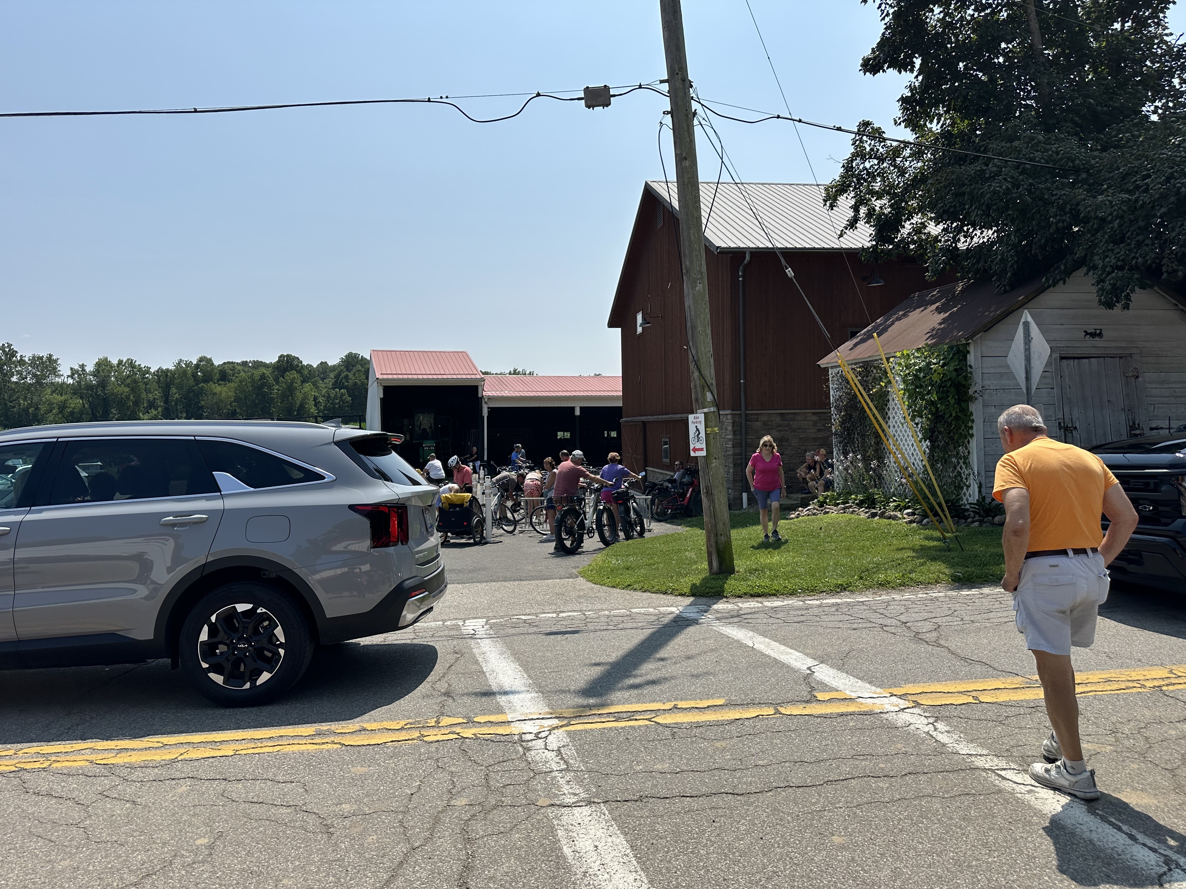
Route photos


Route quality
Waytypes & surfaces along the route
Waytypes
Cycleway
65.4 km
(57 %)
Quiet road
20.6 km
(18 %)
Surfaces
Paved
21.8 km
(19 %)
Unpaved
22.9 km
(20 %)
Paved (undefined)
18.4 km
(16 %)
Loose gravel
17.2 km
(15 %)
Continue with Bikemap
Use, edit, or download this cycling route
You would like to ride day 2 of otet or customize it for your own trip? Here is what you can do with this Bikemap route:
Free features
- Save this route as favorite or in collections
- Copy & plan your own version of this route
- Split it into stages to create a multi-day tour
- Sync your route with Garmin or Wahoo
Premium features
Free trial for 3 days, or one-time payment. More about Bikemap Premium.
- Navigate this route on iOS & Android
- Export a GPX / KML file of this route
- Create your custom printout (try it for free)
- Download this route for offline navigation
Discover more Premium features.
Get Bikemap PremiumFrom our community
Other popular routes starting in Akron
 Bike Party July 2018
- Distance
- 19.9 km
- Ascent
- 209 m
- Descent
- 210 m
- Location
- Akron, Ohio, United States
 Blimp Dock from Hoban
- Distance
- 22.5 km
- Ascent
- 176 m
- Descent
- 215 m
- Location
- Akron, Ohio, United States
 Akron Northside Station to Brecksville Station
- Distance
- 43.4 km
- Ascent
- 251 m
- Descent
- 320 m
- Location
- Akron, Ohio, United States
 Bike Party r1
- Distance
- 18.1 km
- Ascent
- 79 m
- Descent
- 84 m
- Location
- Akron, Ohio, United States
 To buffalo
- Distance
- 164 km
- Ascent
- 720 m
- Descent
- 837 m
- Location
- Akron, Ohio, United States
 Ridge St, Akron to Canal Rd, Valley View
- Distance
- 49.5 km
- Ascent
- 93 m
- Descent
- 175 m
- Location
- Akron, Ohio, United States
 South Main Street 365, Akron to South Main Street 222, Akron
- Distance
- 15.8 km
- Ascent
- 32 m
- Descent
- 33 m
- Location
- Akron, Ohio, United States
 South Main Street 540, Akron to South Main Street 526, Akron
- Distance
- 20.2 km
- Ascent
- 228 m
- Descent
- 216 m
- Location
- Akron, Ohio, United States
Open it in the app