
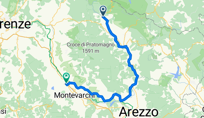
Overview
About this route
- 4 h 48 min
- Duration
- 80.5 km
- Distance
- 245 m
- Ascent
- 566 m
- Descent
- 16.7 km/h
- Avg. speed
- 455 m
- Max. altitude

Part of
Ciclovia dell'Arno
3 stages
Route quality
Waytypes & surfaces along the route
Waytypes
Quiet road
24.9 km
(31 %)
Road
18.5 km
(23 %)
Surfaces
Paved
36.2 km
(45 %)
Unpaved
4 km
(5 %)
Asphalt
35.4 km
(44 %)
Ground
2.4 km
(3 %)
Continue with Bikemap
Use, edit, or download this cycling route
You would like to ride Stia - San Giovanni Valdarno or customize it for your own trip? Here is what you can do with this Bikemap route:
Free features
- Save this route as favorite or in collections
- Copy & plan your own version of this route
- Split it into stages to create a multi-day tour
- Sync your route with Garmin or Wahoo
Premium features
Free trial for 3 days, or one-time payment. More about Bikemap Premium.
- Navigate this route on iOS & Android
- Export a GPX / KML file of this route
- Create your custom printout (try it for free)
- Download this route for offline navigation
Discover more Premium features.
Get Bikemap PremiumFrom our community
Other popular routes starting in Stia
 010 - 2014
- Distance
- 111.2 km
- Ascent
- 326 m
- Descent
- 1,062 m
- Location
- Stia, Tuscany, Italy
 Stia - Castello di Romena - Stia
- Distance
- 9 km
- Ascent
- 293 m
- Descent
- 293 m
- Location
- Stia, Tuscany, Italy
 Anello di Camaldoli da Stia
- Distance
- 37.3 km
- Ascent
- 1,008 m
- Descent
- 1,005 m
- Location
- Stia, Tuscany, Italy
 FORESTA OFF ROAD
- Distance
- 38.8 km
- Ascent
- 1,176 m
- Descent
- 1,096 m
- Location
- Stia, Tuscany, Italy
 Pievi e Castelli 2021
- Distance
- 46.2 km
- Ascent
- 743 m
- Descent
- 733 m
- Location
- Stia, Tuscany, Italy
 Stia - Santuario S. Maria delle Grazie
- Distance
- 4.3 km
- Ascent
- 335 m
- Descent
- 183 m
- Location
- Stia, Tuscany, Italy
 Da Stia all’eremo di Camaldoli via Asqua e per la via dei legni o via dei tedeschi
- Distance
- 48.8 km
- Ascent
- 1,754 m
- Descent
- 1,757 m
- Location
- Stia, Tuscany, Italy
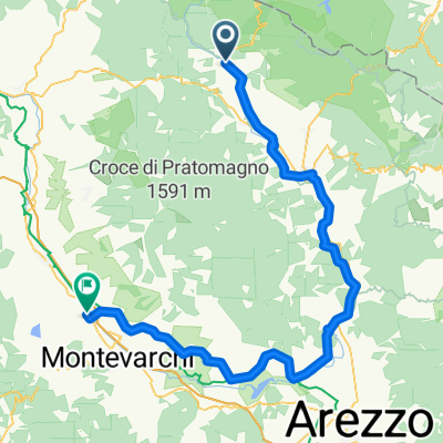 Stia - San Giovanni Valdarno
- Distance
- 80.5 km
- Ascent
- 245 m
- Descent
- 566 m
- Location
- Stia, Tuscany, Italy
Open it in the app