
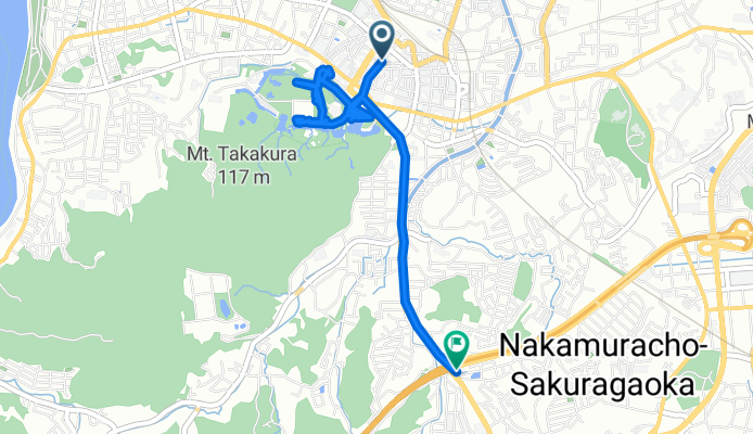
吹上1丁目, 伊勢市へ桜木町, 伊勢市
A cycling route starting in Ise, Mie, Japan.
Overview
About this route
- 3 h 37 min
- Duration
- 6 km
- Distance
- 214 m
- Ascent
- 199 m
- Descent
- 1.7 km/h
- Avg. speed
- 50 m
- Max. altitude

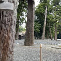
Route photos


Continue with Bikemap
Use, edit, or download this cycling route
You would like to ride 吹上1丁目, 伊勢市へ桜木町, 伊勢市 or customize it for your own trip? Here is what you can do with this Bikemap route:
Free features
- Save this route as favorite or in collections
- Copy & plan your own version of this route
- Sync your route with Garmin or Wahoo
Premium features
Free trial for 3 days, or one-time payment. More about Bikemap Premium.
- Navigate this route on iOS & Android
- Export a GPX / KML file of this route
- Create your custom printout (try it for free)
- Download this route for offline navigation
Discover more Premium features.
Get Bikemap PremiumFrom our community
Other popular routes starting in Ise
 Trans Kii Peninsula (from Ise to Yoshino)
- Distance
- 107.9 km
- Ascent
- 1,024 m
- Descent
- 863 m
- Location
- Ise, Mie, Japan
 自然と田園風景満喫コース
- Distance
- 13.2 km
- Ascent
- 152 m
- Descent
- 149 m
- Location
- Ise, Mie, Japan
 Japan: Ise-Mountains 2
- Distance
- 35.9 km
- Ascent
- 412 m
- Descent
- 412 m
- Location
- Ise, Mie, Japan
 吹上1丁目, 伊勢市へ桜木町, 伊勢市
- Distance
- 6 km
- Ascent
- 214 m
- Descent
- 199 m
- Location
- Ise, Mie, Japan
 織物の神様を巡るコース
- Distance
- 12.2 km
- Ascent
- 25 m
- Descent
- 25 m
- Location
- Ise, Mie, Japan
 Day 601-1
- Distance
- 19 km
- Ascent
- 107 m
- Descent
- 108 m
- Location
- Ise, Mie, Japan
 南勢バイパス, 伊勢市 to 伊勢市
- Distance
- 105.4 km
- Ascent
- 2,306 m
- Descent
- 2,302 m
- Location
- Ise, Mie, Japan
 Ise Sea to Summitish (ca. 55k)
- Distance
- 58.3 km
- Ascent
- 184 m
- Descent
- 184 m
- Location
- Ise, Mie, Japan
Open it in the app