Holschenböhl-Liebenau
A cycling route starting in Liebenau, Lower Saxony, Germany.
Overview
About this route
- -:--
- Duration
- 45 km
- Distance
- 98 m
- Ascent
- 111 m
- Descent
- ---
- Avg. speed
- 66 m
- Max. altitude
Route quality
Waytypes & surfaces along the route
Waytypes
Quiet road
15.8 km
(35 %)
Road
9.5 km
(21 %)
Surfaces
Paved
21.6 km
(48 %)
Unpaved
1.4 km
(3 %)
Asphalt
18 km
(40 %)
Paved (undefined)
3.6 km
(8 %)
Route highlights
Points of interest along the route
Point of interest after 32 km
Point of interest after 45 km
Holschenböhl
Continue with Bikemap
Use, edit, or download this cycling route
You would like to ride Holschenböhl-Liebenau or customize it for your own trip? Here is what you can do with this Bikemap route:
Free features
- Save this route as favorite or in collections
- Copy & plan your own version of this route
- Sync your route with Garmin or Wahoo
Premium features
Free trial for 3 days, or one-time payment. More about Bikemap Premium.
- Navigate this route on iOS & Android
- Export a GPX / KML file of this route
- Create your custom printout (try it for free)
- Download this route for offline navigation
Discover more Premium features.
Get Bikemap PremiumFrom our community
Other popular routes starting in Liebenau
- De Wellie 8, Steyerberg a Wellie 8, Steyerberg
- Distance
- 24.1 km
- Ascent
- 6 m
- Descent
- 50 m
- Location
- Liebenau, Lower Saxony, Germany
- Liebenau-Sulingen Landschaftssee
- Distance
- 29.9 km
- Ascent
- 62 m
- Descent
- 50 m
- Location
- Liebenau, Lower Saxony, Germany
- Denkmaltour 2017
- Distance
- 32.1 km
- Ascent
- 133 m
- Descent
- 127 m
- Location
- Liebenau, Lower Saxony, Germany
- Liebenau - Minden
- Distance
- 45.7 km
- Ascent
- 61 m
- Descent
- 46 m
- Location
- Liebenau, Lower Saxony, Germany
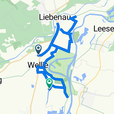
- De Stolzenauer Straße 11-64, Steyerberg a Wellie 8, Steyerberg
- Distance
- 6 km
- Ascent
- 10 m
- Descent
- 47 m
- Location
- Liebenau, Lower Saxony, Germany
- Holschenböhl-Liebenau
- Distance
- 45 km
- Ascent
- 98 m
- Descent
- 111 m
- Location
- Liebenau, Lower Saxony, Germany
- Uchte
- Distance
- 40.4 km
- Ascent
- 116 m
- Descent
- 103 m
- Location
- Liebenau, Lower Saxony, Germany
- Rund um Liebenau 31km
- Distance
- 30.7 km
- Ascent
- 216 m
- Descent
- 215 m
- Location
- Liebenau, Lower Saxony, Germany
Open it in the app