
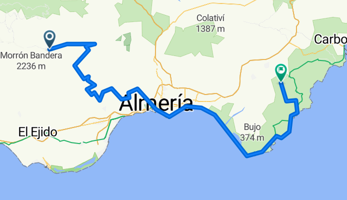
Overview
About this route
- 7 h 26 min
- Duration
- 122.6 km
- Distance
- 608 m
- Ascent
- 1,232 m
- Descent
- 16.5 km/h
- Avg. speed
- 1,241 m
- Max. altitude
Part of
Transandalus
17 stages
Continue with Bikemap
Use, edit, or download this cycling route
You would like to ride Padules - Níjar or customize it for your own trip? Here is what you can do with this Bikemap route:
Free features
- Save this route as favorite or in collections
- Copy & plan your own version of this route
- Split it into stages to create a multi-day tour
- Sync your route with Garmin or Wahoo
Premium features
Free trial for 3 days, or one-time payment. More about Bikemap Premium.
- Navigate this route on iOS & Android
- Export a GPX / KML file of this route
- Create your custom printout (try it for free)
- Download this route for offline navigation
Discover more Premium features.
Get Bikemap PremiumFrom our community
Other popular routes starting in Padules
 Los 3x2000 Sierra de Gador
- Distance
- 90.9 km
- Ascent
- 2,234 m
- Descent
- 1,273 m
- Location
- Padules, Andalusia, Spain
 Padules-Padules por Cacín
- Distance
- 23.3 km
- Ascent
- 665 m
- Descent
- 664 m
- Location
- Padules, Andalusia, Spain
 Padules - Merendero de Polarda
- Distance
- 51.4 km
- Ascent
- 1,513 m
- Descent
- 1,512 m
- Location
- Padules, Andalusia, Spain
 I Alpujarra y Pedal-Padules 25-09-2010
- Distance
- 95.6 km
- Ascent
- 2,256 m
- Descent
- 2,260 m
- Location
- Padules, Andalusia, Spain
 Desde Alcora al cruce de Fondon por la carretera antigua.
- Distance
- 11 km
- Ascent
- 297 m
- Descent
- 247 m
- Location
- Padules, Andalusia, Spain
 Padules - Níjar
- Distance
- 122.6 km
- Ascent
- 608 m
- Descent
- 1,232 m
- Location
- Padules, Andalusia, Spain
 Padules - FV - Minas de Martos - Fte. La Parra - Venta del Cacin
- Distance
- 58.7 km
- Ascent
- 1,351 m
- Descent
- 1,355 m
- Location
- Padules, Andalusia, Spain
 Padules - Merendero de Polarda
- Distance
- 51.4 km
- Ascent
- 1,476 m
- Descent
- 1,475 m
- Location
- Padules, Andalusia, Spain
Open it in the app