
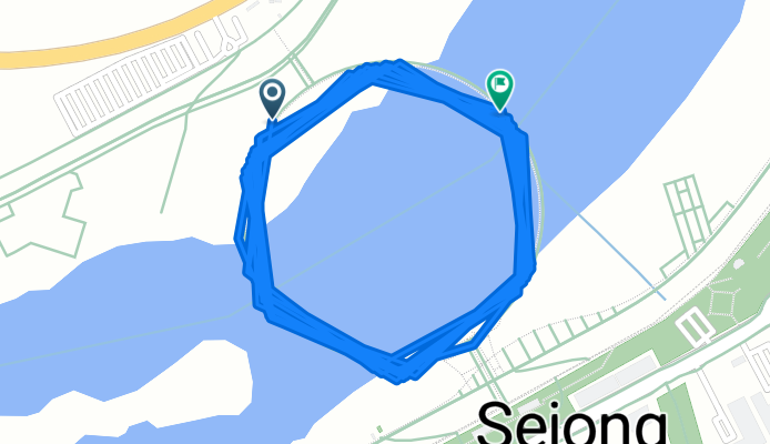
세종 이응교 19.47km
A cycling route starting in Songgangdong, Daejeon, South Korea.
Overview
About this route
- 54 min
- Duration
- 19.5 km
- Distance
- 432 m
- Ascent
- 458 m
- Descent
- 21.5 km/h
- Avg. speed
- 60 m
- Max. altitude

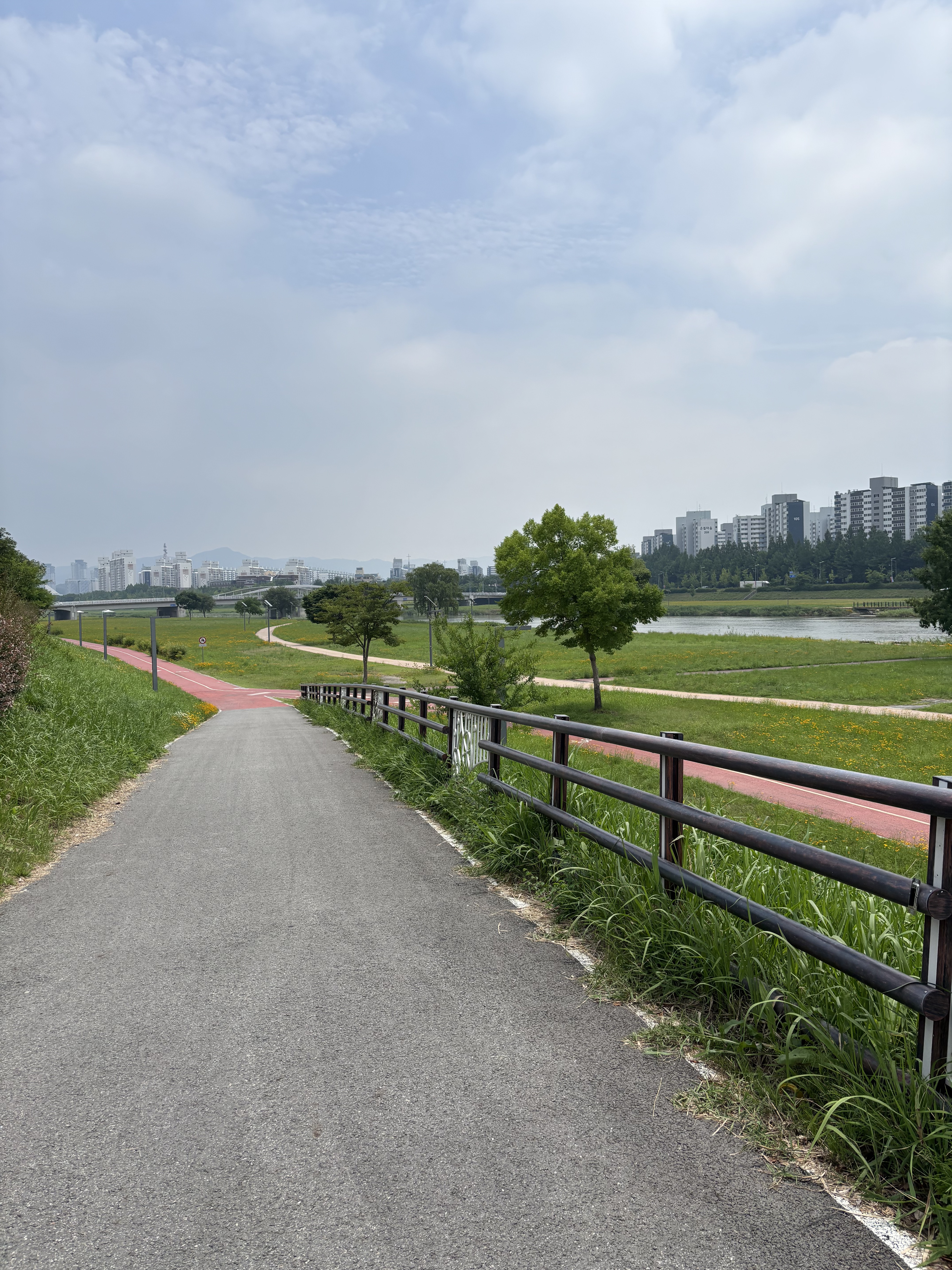
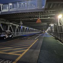
Route photos


Continue with Bikemap
Use, edit, or download this cycling route
You would like to ride 세종 이응교 19.47km or customize it for your own trip? Here is what you can do with this Bikemap route:
Free features
- Save this route as favorite or in collections
- Copy & plan your own version of this route
- Sync your route with Garmin or Wahoo
Premium features
Free trial for 3 days, or one-time payment. More about Bikemap Premium.
- Navigate this route on iOS & Android
- Export a GPX / KML file of this route
- Create your custom printout (try it for free)
- Download this route for offline navigation
Discover more Premium features.
Get Bikemap PremiumFrom our community
Other popular routes starting in Songgangdong
 대학로291번가길, 대전광역시에서 대학로291번가길, 대전광역시까지
- Distance
- 13.7 km
- Ascent
- 146 m
- Descent
- 149 m
- Location
- Songgangdong, Daejeon, South Korea
 와장신 싱글 ~ 로하스
- Distance
- 18.7 km
- Ascent
- 593 m
- Descent
- 574 m
- Location
- Songgangdong, Daejeon, South Korea
 세종 이응교 19.47km
- Distance
- 19.5 km
- Ascent
- 432 m
- Descent
- 458 m
- Location
- Songgangdong, Daejeon, South Korea
 햇무리교-세종호수공원-이응다리
- Distance
- 16.1 km
- Ascent
- 43 m
- Descent
- 39 m
- Location
- Songgangdong, Daejeon, South Korea
 지족동 233-14 ~ 58
- Distance
- 6 km
- Ascent
- 0 m
- Descent
- 78 m
- Location
- Songgangdong, Daejeon, South Korea
 세종보-대청댐
- Distance
- 34.2 km
- Ascent
- 170 m
- Descent
- 133 m
- Location
- Songgangdong, Daejeon, South Korea
 지족산 싱글
- Distance
- 12.4 km
- Ascent
- 432 m
- Descent
- 399 m
- Location
- Songgangdong, Daejeon, South Korea
 유성 ~ 비학산 ~ 금병산
- Distance
- 32.4 km
- Ascent
- 983 m
- Descent
- 963 m
- Location
- Songgangdong, Daejeon, South Korea
Open it in the app