
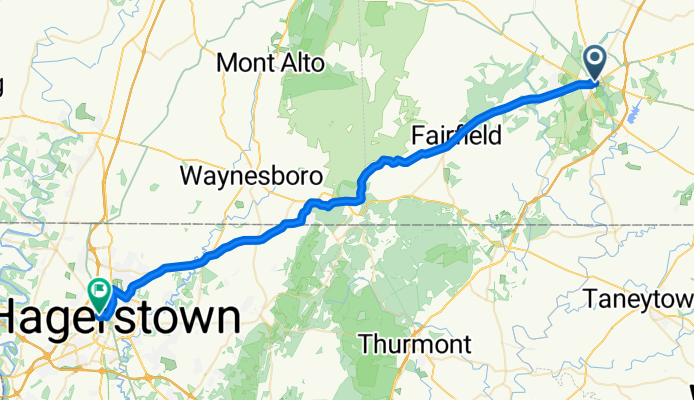
York Street to National Pike
A cycling route starting in Gettysburg, Pennsylvania, United States.
Overview
About this route
- 4 h 45 min
- Duration
- 54.8 km
- Distance
- 552 m
- Ascent
- 493 m
- Descent
- 11.5 km/h
- Avg. speed
- 449 m
- Max. altitude
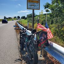
Route photos


Route quality
Waytypes & surfaces along the route
Waytypes
Busy road
22.7 km
(41 %)
Road
12.6 km
(23 %)
Surfaces
Paved
13.2 km
(24 %)
Asphalt
13 km
(24 %)
Concrete
0.2 km
(<1 %)
Undefined
41.5 km
(76 %)
Continue with Bikemap
Use, edit, or download this cycling route
You would like to ride York Street to National Pike or customize it for your own trip? Here is what you can do with this Bikemap route:
Free features
- Save this route as favorite or in collections
- Copy & plan your own version of this route
- Sync your route with Garmin or Wahoo
Premium features
Free trial for 3 days, or one-time payment. More about Bikemap Premium.
- Navigate this route on iOS & Android
- Export a GPX / KML file of this route
- Create your custom printout (try it for free)
- Download this route for offline navigation
Discover more Premium features.
Get Bikemap PremiumFrom our community
Other popular routes starting in Gettysburg
 York Street to National Pike
- Distance
- 54.8 km
- Ascent
- 552 m
- Descent
- 493 m
- Location
- Gettysburg, Pennsylvania, United States
 Gettysburg
- Distance
- 15.5 km
- Ascent
- 151 m
- Descent
- 150 m
- Location
- Gettysburg, Pennsylvania, United States
 Gettysburg
- Distance
- 9.4 km
- Ascent
- 150 m
- Descent
- 124 m
- Location
- Gettysburg, Pennsylvania, United States
 Gettysburg with Penns
- Distance
- 30.7 km
- Ascent
- 369 m
- Descent
- 372 m
- Location
- Gettysburg, Pennsylvania, United States
 2030 Fairfield Rd, Gettysburg to 2030 Fairfield Rd, Gettysburg
- Distance
- 13.2 km
- Ascent
- 117 m
- Descent
- 117 m
- Location
- Gettysburg, Pennsylvania, United States
 98 Lefever St, Gettysburg to 127–199 Lefever St, Gettysburg
- Distance
- 17.3 km
- Ascent
- 192 m
- Descent
- 192 m
- Location
- Gettysburg, Pennsylvania, United States
 Bear Reaching for Honey
- Distance
- 33.6 km
- Ascent
- 180 m
- Descent
- 181 m
- Location
- Gettysburg, Pennsylvania, United States
 Emmitsburg option B
- Distance
- 68 km
- Ascent
- 298 m
- Descent
- 298 m
- Location
- Gettysburg, Pennsylvania, United States
Open it in the app