
Grand tour Léry- Châteauguay
A cycling route starting in Beauharnois, Quebec, Canada.
Overview
About this route
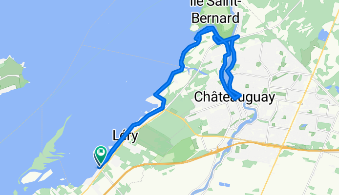
A loop starting from the municipal dock of Léry takes you along the Lac Saint-Louis path, passing over the wooden Châteauguay-Léry bridge, the communal park in Châteauguay, Boulevard Youville, and Salaberry, marked for safety.
- 1 h 15 min
- Duration
- 24.8 km
- Distance
- 66 m
- Ascent
- 65 m
- Descent
- 19.9 km/h
- Avg. speed
- 37 m
- Max. altitude

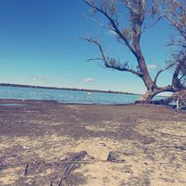
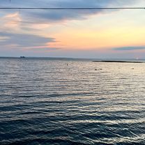
Route photos


Route quality
Waytypes & surfaces along the route
Waytypes
Quiet road
16.1 km
(65 %)
Cycleway
4.7 km
(19 %)
Road
4 km
(16 %)
Surfaces
Paved
24 km
(97 %)
Unpaved
0.5 km
(2 %)
Asphalt
24 km
(97 %)
Loose gravel
0.5 km
(2 %)
Undefined
0.2 km
(1 %)
Continue with Bikemap
Use, edit, or download this cycling route
You would like to ride Grand tour Léry- Châteauguay or customize it for your own trip? Here is what you can do with this Bikemap route:
Free features
- Save this route as favorite or in collections
- Copy & plan your own version of this route
- Sync your route with Garmin or Wahoo
Premium features
Free trial for 3 days, or one-time payment. More about Bikemap Premium.
- Navigate this route on iOS & Android
- Export a GPX / KML file of this route
- Create your custom printout (try it for free)
- Download this route for offline navigation
Discover more Premium features.
Get Bikemap PremiumFrom our community
Other popular routes starting in Beauharnois
 37 Rue Bourcier, Melocheville to 136–140 Rue Victoria, Salaberry-de-Valleyfield
- Distance
- 19.1 km
- Ascent
- 40 m
- Descent
- 25 m
- Location
- Beauharnois, Quebec, Canada
 Rive-Sud de Montréal, Beauharnois à Rive-Sud de Montréal, Léry
- Distance
- 3.9 km
- Ascent
- 204 m
- Descent
- 212 m
- Location
- Beauharnois, Quebec, Canada
 Grand tour Léry- Châteauguay
- Distance
- 24.8 km
- Ascent
- 66 m
- Descent
- 65 m
- Location
- Beauharnois, Quebec, Canada
 Beauharnois-St. Louis de Gonzague
- Distance
- 66.6 km
- Ascent
- 23 m
- Descent
- 21 m
- Location
- Beauharnois, Quebec, Canada
 50 Ch des Hauts-Fourneaux, Beauharnois à 48–50 Ch des Hauts-Fourneaux, Beauharnois
- Distance
- 10.1 km
- Ascent
- 1,189 m
- Descent
- 1,185 m
- Location
- Beauharnois, Quebec, Canada
 50 Rue Bourcier, Beauharnois to 1167 Ch du Fleuve, Les Cèdres
- Distance
- 15 km
- Ascent
- 26 m
- Descent
- 16 m
- Location
- Beauharnois, Quebec, Canada
 2021 season num 2
- Distance
- 37.5 km
- Ascent
- 44 m
- Descent
- 43 m
- Location
- Beauharnois, Quebec, Canada
 Beauharnois
- Distance
- 69.2 km
- Ascent
- 60 m
- Descent
- 62 m
- Location
- Beauharnois, Quebec, Canada
Open it in the app