
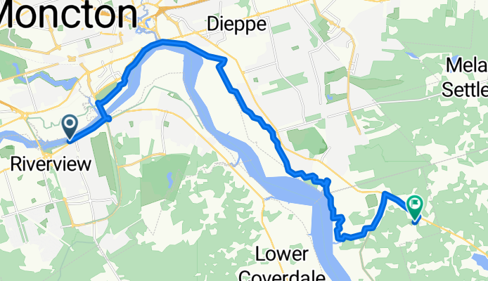
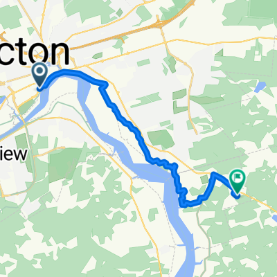
Coverdale Rd, Riverview to Raphael St, Dieppe
A cycling route starting in Moncton, New Brunswick, Canada.
Overview
About this route
- 1 h 3 min
- Duration
- 18.4 km
- Distance
- 156 m
- Ascent
- 87 m
- Descent
- 17.3 km/h
- Avg. speed
- 84 m
- Max. altitude
Route quality
Waytypes & surfaces along the route
Waytypes
Cycleway
14.7 km
(80 %)
Path
0.9 km
(5 %)
Surfaces
Paved
5.3 km
(29 %)
Unpaved
12.5 km
(68 %)
Loose gravel
10.5 km
(57 %)
Paved (undefined)
2.4 km
(13 %)
Continue with Bikemap
Use, edit, or download this cycling route
You would like to ride Coverdale Rd, Riverview to Raphael St, Dieppe or customize it for your own trip? Here is what you can do with this Bikemap route:
Free features
- Save this route as favorite or in collections
- Copy & plan your own version of this route
- Sync your route with Garmin or Wahoo
Premium features
Free trial for 3 days, or one-time payment. More about Bikemap Premium.
- Navigate this route on iOS & Android
- Export a GPX / KML file of this route
- Create your custom printout (try it for free)
- Download this route for offline navigation
Discover more Premium features.
Get Bikemap PremiumFrom our community
Other popular routes starting in Moncton
 From Moncton to Shediac
- Distance
- 73.1 km
- Ascent
- 227 m
- Descent
- 221 m
- Location
- Moncton, New Brunswick, Canada
 Grand Trunk Street to Lester Avenue
- Distance
- 14 km
- Ascent
- 329 m
- Descent
- 301 m
- Location
- Moncton, New Brunswick, Canada
 Evergreen Dr, Moncton to Evergreen Dr, Moncton
- Distance
- 21.3 km
- Ascent
- 122 m
- Descent
- 121 m
- Location
- Moncton, New Brunswick, Canada
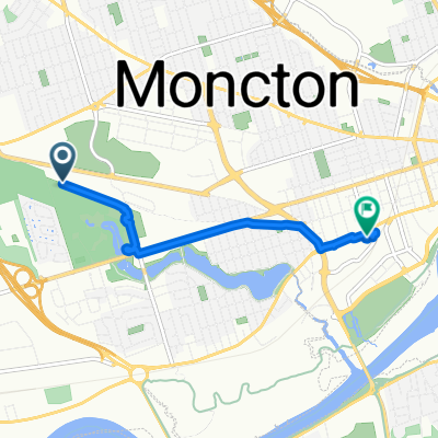
 Assomption Blvd, Moncton to Raphael St, Dieppe
- Distance
- 15.1 km
- Ascent
- 173 m
- Descent
- 95 m
- Location
- Moncton, New Brunswick, Canada
 Noble Crescent to Noble Crescent
- Distance
- 4.6 km
- Ascent
- 27 m
- Descent
- 6 m
- Location
- Moncton, New Brunswick, Canada
 Old Coach Rd, Riverview to Old Coach Rd, Riverview
- Distance
- 67.9 km
- Ascent
- 599 m
- Descent
- 602 m
- Location
- Moncton, New Brunswick, Canada
 Millennium Boulevard to Main Street
- Distance
- 5.2 km
- Ascent
- 69 m
- Descent
- 46 m
- Location
- Moncton, New Brunswick, Canada
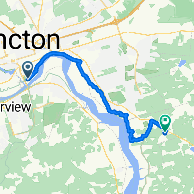 Gunningsville Bridge, Moncton to Raphael St, Dieppe
- Distance
- 16.2 km
- Ascent
- 171 m
- Descent
- 102 m
- Location
- Moncton, New Brunswick, Canada
Open it in the app