
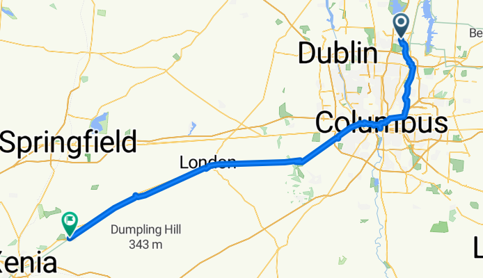
day 4 otet - Westerville to cedarville
A cycling route starting in Westerville, Ohio, United States.
Overview
About this route
- 7 h 59 min
- Duration
- 112.8 km
- Distance
- 352 m
- Ascent
- 285 m
- Descent
- 14.1 km/h
- Avg. speed
- 353 m
- Max. altitude

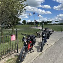
Route photos


Route quality
Waytypes & surfaces along the route
Waytypes
Cycleway
98.2 km
(87 %)
Path
4.5 km
(4 %)
Surfaces
Paved
80.1 km
(71 %)
Asphalt
42.9 km
(38 %)
Paved (undefined)
36.1 km
(32 %)
Continue with Bikemap
Use, edit, or download this cycling route
You would like to ride day 4 otet - Westerville to cedarville or customize it for your own trip? Here is what you can do with this Bikemap route:
Free features
- Save this route as favorite or in collections
- Copy & plan your own version of this route
- Split it into stages to create a multi-day tour
- Sync your route with Garmin or Wahoo
Premium features
Free trial for 3 days, or one-time payment. More about Bikemap Premium.
- Navigate this route on iOS & Android
- Export a GPX / KML file of this route
- Create your custom printout (try it for free)
- Download this route for offline navigation
Discover more Premium features.
Get Bikemap PremiumFrom our community
Other popular routes starting in Westerville
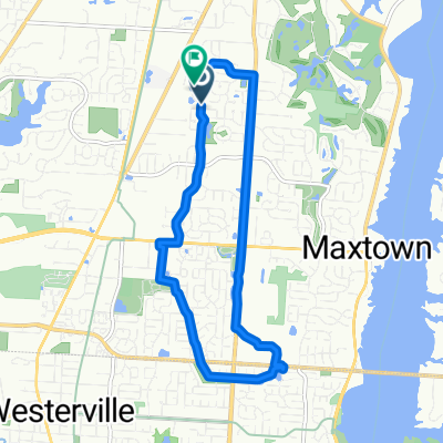
 McNamara - Galena
- Distance
- 5.5 km
- Ascent
- 19 m
- Descent
- 28 m
- Location
- Westerville, Ohio, United States
 day 4 otet - Westerville to cedarville
- Distance
- 112.8 km
- Ascent
- 352 m
- Descent
- 285 m
- Location
- Westerville, Ohio, United States
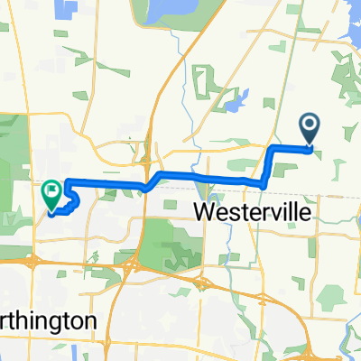
 Baneberry Dr, Westerville to Baneberry Dr, Westerville
- Distance
- 11 km
- Ascent
- 29 m
- Descent
- 30 m
- Location
- Westerville, Ohio, United States
 Red Bank +threshold
- Distance
- 45.1 km
- Ascent
- 119 m
- Descent
- 119 m
- Location
- Westerville, Ohio, United States
 Alum Creek Trail
- Distance
- 22.4 km
- Ascent
- 31 m
- Descent
- 46 m
- Location
- Westerville, Ohio, United States
 Westerville to West Chester
- Distance
- 191.1 km
- Ascent
- 319 m
- Descent
- 359 m
- Location
- Westerville, Ohio, United States
 Hillegas Farm Dr, Westerville to Leaview Dr, Columbus
- Distance
- 12.3 km
- Ascent
- 36 m
- Descent
- 38 m
- Location
- Westerville, Ohio, United States
 Seraphim Court 7293, Galena to Genoa Farms Boulevard 5538, Westerville
- Distance
- 1 km
- Ascent
- 4 m
- Descent
- 0 m
- Location
- Westerville, Ohio, United States
Open it in the app