
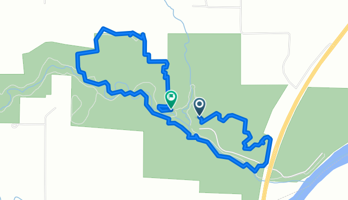
44.268, -94.034 to 44.266, -94.035
A cycling route starting in Saint Peter, Minnesota, United States.
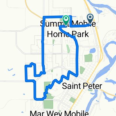
Overview
About this route
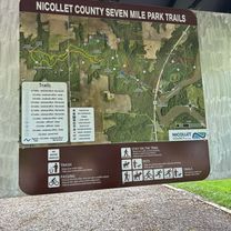
Took gunner for a walk with cody
- 2 h 9 min
- Duration
- 6.5 km
- Distance
- 185 m
- Ascent
- 209 m
- Descent
- 3 km/h
- Avg. speed
- 301 m
- Max. altitude
Route photos


Route quality
Waytypes & surfaces along the route
Waytypes
Path
5.8 km
(90 %)
Pedestrian area
0.6 km
(10 %)
Surfaces
Paved
1.4 km
(22 %)
Unpaved
1.4 km
(21 %)
Asphalt
1.4 km
(22 %)
Gravel
1.1 km
(17 %)
Continue with Bikemap
Use, edit, or download this cycling route
You would like to ride 44.268, -94.034 to 44.266, -94.035 or customize it for your own trip? Here is what you can do with this Bikemap route:
Free features
- Save this route as favorite or in collections
- Copy & plan your own version of this route
- Sync your route with Garmin or Wahoo
Premium features
Free trial for 3 days, or one-time payment. More about Bikemap Premium.
- Navigate this route on iOS & Android
- Export a GPX / KML file of this route
- Create your custom printout (try it for free)
- Download this route for offline navigation
Discover more Premium features.
Get Bikemap PremiumFrom our community
Other popular routes starting in Saint Peter
 1719 N Fifth St, Saint Peter to 1719 N Fifth St, Saint Peter
- Distance
- 2.5 km
- Ascent
- 29 m
- Descent
- 27 m
- Location
- Saint Peter, Minnesota, United States
 Restful route in Saint Peter
- Distance
- 3.4 km
- Ascent
- 20 m
- Descent
- 17 m
- Location
- Saint Peter, Minnesota, United States
 44.268, -94.034 to 44.266, -94.035
- Distance
- 6.5 km
- Ascent
- 185 m
- Descent
- 209 m
- Location
- Saint Peter, Minnesota, United States
 St Peter
- Distance
- 14.9 km
- Ascent
- 89 m
- Descent
- 58 m
- Location
- Saint Peter, Minnesota, United States
 Cleveland back to Le Center
- Distance
- 11.5 km
- Ascent
- 34 m
- Descent
- 23 m
- Location
- Saint Peter, Minnesota, United States
 Route to 1719 N Fifth St, Saint Peter
- Distance
- 2.2 km
- Ascent
- 30 m
- Descent
- 30 m
- Location
- Saint Peter, Minnesota, United States
 2001 Sunrise Dr, Saint Peter to 2013 Bunker Ln, Saint Peter
- Distance
- 4.9 km
- Ascent
- 46 m
- Descent
- 45 m
- Location
- Saint Peter, Minnesota, United States
 1901 Sunrise Dr, Saint Peter to 2001 Sunrise Dr, Saint Peter
- Distance
- 9.3 km
- Ascent
- 65 m
- Descent
- 64 m
- Location
- Saint Peter, Minnesota, United States
Open it in the app