
Auf ehemaligen Bahntrassen von Augsburg nach Söhlde
Bad Neustadt an der Saale Cycling
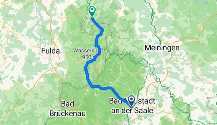
A cycling route starting in Bad Neustadt an der Saale, Bavaria, Germany.
Overview
About this route
- 7 h 41 min
- Duration
- 69.5 km
- Distance
- 827 m
- Ascent
- 762 m
- Descent
- 9 km/h
- Avg. speed
- 721 m
- Max. altitude

Part of
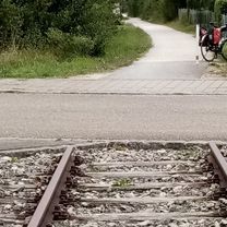
Route photos

Route quality
Waytypes & surfaces along the route
Waytypes
Path
17.4 km
(25 %)
Track
15.3 km
(22 %)
Surfaces
Paved
63.2 km
(91 %)
Unpaved
1.4 km
(2 %)
Asphalt
57.7 km
(83 %)
Paved (undefined)
5.6 km
(8 %)
Continue with Bikemap
Use, edit, or download this cycling route
You would like to ride Bad Neustadt an der Saale Cycling or customize it for your own trip? Here is what you can do with this Bikemap route:
Free features
- Save this route as favorite or in collections
- Copy & plan your own version of this route
- Sync your route with Garmin or Wahoo
Premium features
Free trial for 3 days, or one-time payment. More about Bikemap Premium.
- Navigate this route on iOS & Android
- Export a GPX / KML file of this route
- Create your custom printout (try it for free)
- Download this route for offline navigation
Discover more Premium features.
Get Bikemap PremiumFrom our community
Other popular routes starting in Bad Neustadt an der Saale
 90km Kuppenritt
- Distance
- 88.9 km
- Ascent
- 1,380 m
- Descent
- 1,380 m
- Location
- Bad Neustadt an der Saale, Bavaria, Germany
 Tag2 Main-Rhön
- Distance
- 75 km
- Ascent
- 0 m
- Descent
- 0 m
- Location
- Bad Neustadt an der Saale, Bavaria, Germany
 XXI Erfurter Bike Challenge 2025
- Distance
- 269 km
- Ascent
- 2,648 m
- Descent
- 2,743 m
- Location
- Bad Neustadt an der Saale, Bavaria, Germany
 Röhn Kuppenritt 160 km
- Distance
- 157.6 km
- Ascent
- 2,167 m
- Descent
- 2,077 m
- Location
- Bad Neustadt an der Saale, Bavaria, Germany
 Vom Main zur Rhön
- Distance
- 256.8 km
- Ascent
- 801 m
- Descent
- 801 m
- Location
- Bad Neustadt an der Saale, Bavaria, Germany
 Bad Neustadt A 158
- Distance
- 157.9 km
- Ascent
- 1,611 m
- Descent
- 1,611 m
- Location
- Bad Neustadt an der Saale, Bavaria, Germany
 Hollstadt Trail
- Distance
- 21.2 km
- Ascent
- 377 m
- Descent
- 377 m
- Location
- Bad Neustadt an der Saale, Bavaria, Germany
 Remap of Müller Dietmar's Buschwindröschen
- Distance
- 34.8 km
- Ascent
- 416 m
- Descent
- 417 m
- Location
- Bad Neustadt an der Saale, Bavaria, Germany
Open it in the app