Balatonkör
A cycling route starting in Siófok, Somogy County, Hungary.
Overview
About this route
- -:--
- Duration
- 212.6 km
- Distance
- 263 m
- Ascent
- 261 m
- Descent
- ---
- Avg. speed
- ---
- Max. altitude
Route quality
Waytypes & surfaces along the route
Waytypes
Quiet road
65.9 km
(31 %)
Cycleway
63.8 km
(30 %)
Surfaces
Paved
199.8 km
(94 %)
Unpaved
2.1 km
(1 %)
Asphalt
199.8 km
(94 %)
Ground
2.1 km
(1 %)
Undefined
10.6 km
(5 %)
Route highlights
Points of interest along the route
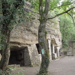
Photo after 57.4 km
Barátlakások Az Óvár keleti oldalába, a húsz méter magas bazalttufa falba vájt barlanglakások feltehetően az I. András király által Tihanyba telepített bazilita szerzetesek építményei.

Photo after 60.2 km
Tihanyi Bencés Apátság
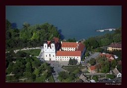
Point of interest after 60.2 km
Tihanyi Bencés Apátság
Photo after 60.4 km
Tihanyi-Echo
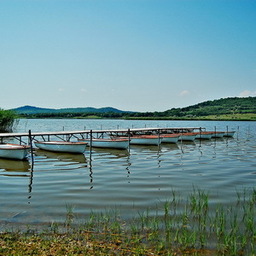
Photo after 60.9 km
A tó mintegy 25 méterrel magasabban fekszik, mint a Balaton, azzal nincs összeköttetése. Vízének mégis van bizonyos mértékű lefolyása. A szivárgó víz pl. 1930-ban földcsuszamlást okozott. A Belső-tó életének változásait mintegy hetven évre visszamenőleg lehet biztonsággal végigkövetni.
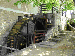
Photo after 67 km
Örvényesi vízimalom

Photo after 89.3 km
Révfülöp - Fülöp-hegyi Millenniumi kilátó
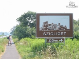
Point of interest after 109.7 km
Szigligeti vár
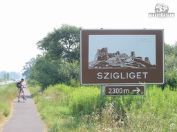
Photo after 110.5 km
Szigligeti vár

Photo after 111.4 km
Szigliget, Eszterházy kastély
Continue with Bikemap
Use, edit, or download this cycling route
You would like to ride Balatonkör or customize it for your own trip? Here is what you can do with this Bikemap route:
Free features
- Save this route as favorite or in collections
- Copy & plan your own version of this route
- Split it into stages to create a multi-day tour
- Sync your route with Garmin or Wahoo
Premium features
Free trial for 3 days, or one-time payment. More about Bikemap Premium.
- Navigate this route on iOS & Android
- Export a GPX / KML file of this route
- Create your custom printout (try it for free)
- Download this route for offline navigation
Discover more Premium features.
Get Bikemap PremiumFrom our community
Other popular routes starting in Siófok
 2014. év 9. 1/3 Balaton kerékpártúra (kis kör 75km)
- Distance
- 74.3 km
- Ascent
- 182 m
- Descent
- 182 m
- Location
- Siófok, Somogy County, Hungary
 Kis Somogyi-dombság
- Distance
- 38.5 km
- Ascent
- 146 m
- Descent
- 145 m
- Location
- Siófok, Somogy County, Hungary
 Siófok to Balatonfured
- Distance
- 28 km
- Ascent
- 141 m
- Descent
- 147 m
- Location
- Siófok, Somogy County, Hungary
 Balaton 01 - Siofok Balatonalmadi
- Distance
- 33.6 km
- Ascent
- 106 m
- Descent
- 98 m
- Location
- Siófok, Somogy County, Hungary
 Balaton keleti kis kör
- Distance
- 77.8 km
- Ascent
- 262 m
- Descent
- 262 m
- Location
- Siófok, Somogy County, Hungary
 Kis-Kör Balaton
- Distance
- 85.7 km
- Ascent
- 152 m
- Descent
- 155 m
- Location
- Siófok, Somogy County, Hungary
 Balatonkör
- Distance
- 212.6 km
- Ascent
- 263 m
- Descent
- 261 m
- Location
- Siófok, Somogy County, Hungary
 Kele utca 5, Siófok - Széchenyi István utca 26, Balatonfüred
- Distance
- 70.5 km
- Ascent
- 309 m
- Descent
- 305 m
- Location
- Siófok, Somogy County, Hungary
Open it in the app


