
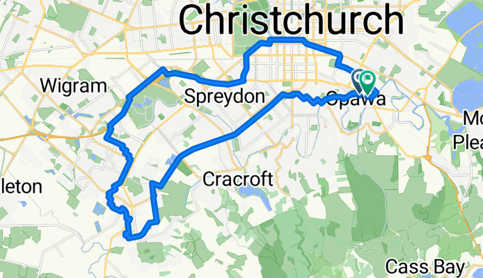
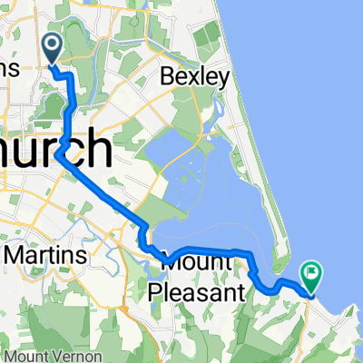
Vincent Place to halswell
A cycling route starting in Christchurch, Canterbury, New Zealand.
Overview
About this route
- 1 h 41 min
- Duration
- 30.1 km
- Distance
- 53 m
- Ascent
- 54 m
- Descent
- 17.8 km/h
- Avg. speed
- 22 m
- Max. altitude
Route quality
Waytypes & surfaces along the route
Waytypes
Cycleway
16.5 km
(55 %)
Quiet road
9.3 km
(31 %)
Surfaces
Paved
29.2 km
(97 %)
Asphalt
28.6 km
(95 %)
Paved (undefined)
0.6 km
(2 %)
Undefined
0.9 km
(3 %)
Continue with Bikemap
Use, edit, or download this cycling route
You would like to ride Vincent Place to halswell or customize it for your own trip? Here is what you can do with this Bikemap route:
Free features
- Save this route as favorite or in collections
- Copy & plan your own version of this route
- Sync your route with Garmin or Wahoo
Premium features
Free trial for 3 days, or one-time payment. More about Bikemap Premium.
- Navigate this route on iOS & Android
- Export a GPX / KML file of this route
- Create your custom printout (try it for free)
- Download this route for offline navigation
Discover more Premium features.
Get Bikemap PremiumFrom our community
Other popular routes starting in Christchurch
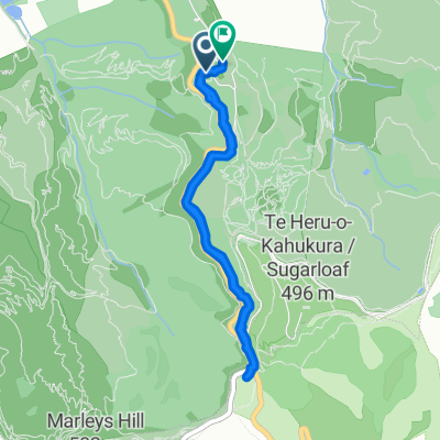 Restful route
- Distance
- 5.3 km
- Ascent
- 433 m
- Descent
- 156 m
- Location
- Christchurch, Canterbury, New Zealand
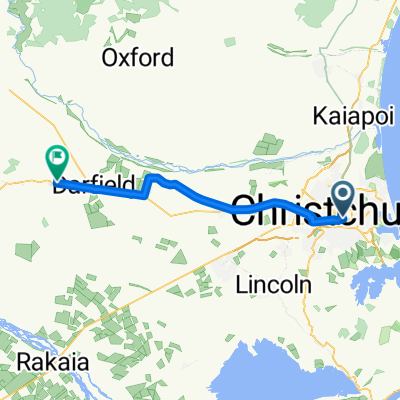 Christchurch - Darfield
- Distance
- 54.4 km
- Ascent
- 214 m
- Descent
- 9 m
- Location
- Christchurch, Canterbury, New Zealand
 St James Ave, Christchurch to St James Ave, Christchurch
- Distance
- 11.1 km
- Ascent
- 50 m
- Descent
- 53 m
- Location
- Christchurch, Canterbury, New Zealand
 Netherby Ln, Christchurch to Netherby Ln, Christchurch
- Distance
- 33.9 km
- Ascent
- 57 m
- Descent
- 58 m
- Location
- Christchurch, Canterbury, New Zealand
 Netherby Ln, Christchurch to Netherby Ln, Christchurch
- Distance
- 38.3 km
- Ascent
- 93 m
- Descent
- 83 m
- Location
- Christchurch, Canterbury, New Zealand
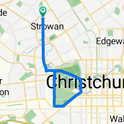
 Route to Addington
- Distance
- 33.6 km
- Ascent
- 691 m
- Descent
- 693 m
- Location
- Christchurch, Canterbury, New Zealand
 Vincent Place to PMH VIA WESTMORELAND
- Distance
- 18.8 km
- Ascent
- 155 m
- Descent
- 154 m
- Location
- Christchurch, Canterbury, New Zealand
 Netherby Ln, Christchurch to Marriner St, Christchurch
- Distance
- 14.1 km
- Ascent
- 25 m
- Descent
- 26 m
- Location
- Christchurch, Canterbury, New Zealand
Open it in the app