
From Östringen to Düsseldorf
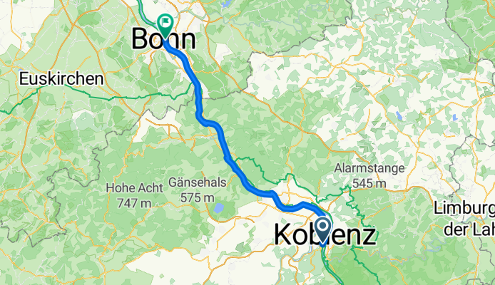
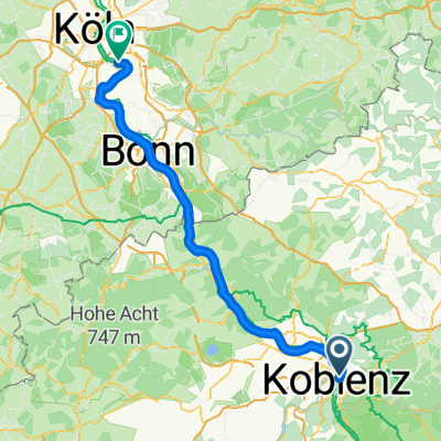
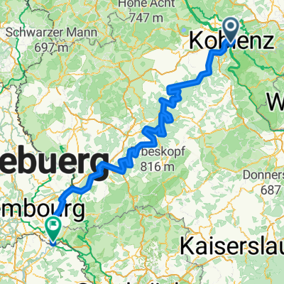
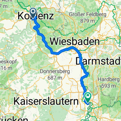
Koblenz - Bonn
A cycling route starting in Koblenz, Rhineland-Palatinate, Germany.
Overview
About this route
- 4 h 24 min
- Duration
- 70.5 km
- Distance
- 404 m
- Ascent
- 415 m
- Descent
- 16 km/h
- Avg. speed
- 106 m
- Max. altitude
Part of
From Östringen to Düsseldorf
4 stages
Route quality
Waytypes & surfaces along the route
Waytypes
Path
36.7 km
(52 %)
Quiet road
18.3 km
(26 %)
Surfaces
Paved
51.5 km
(73 %)
Asphalt
50.8 km
(72 %)
Concrete
0.7 km
(1 %)
Undefined
19 km
(27 %)
Continue with Bikemap
Use, edit, or download this cycling route
You would like to ride Koblenz - Bonn or customize it for your own trip? Here is what you can do with this Bikemap route:
Free features
- Save this route as favorite or in collections
- Copy & plan your own version of this route
- Sync your route with Garmin or Wahoo
Premium features
Free trial for 3 days, or one-time payment. More about Bikemap Premium.
- Navigate this route on iOS & Android
- Export a GPX / KML file of this route
- Create your custom printout (try it for free)
- Download this route for offline navigation
Discover more Premium features.
Get Bikemap PremiumFrom our community
Other popular routes starting in Koblenz
 Mosel Thionville Mosel
- Distance
- 267 km
- Ascent
- 1,060 m
- Descent
- 989 m
- Location
- Koblenz, Rhineland-Palatinate, Germany
 Weißenthurm - Altstadt Sud
- Distance
- 94.4 km
- Ascent
- 460 m
- Descent
- 482 m
- Location
- Koblenz, Rhineland-Palatinate, Germany
 Koblenz naar Hindenburganlage, Bingen am Rhein
- Distance
- 61.5 km
- Ascent
- 194 m
- Descent
- 168 m
- Location
- Koblenz, Rhineland-Palatinate, Germany
- Von Mayen (Osteifel) nach Koblenz (Rhein)
- Distance
- 54.9 km
- Ascent
- 421 m
- Descent
- 223 m
- Location
- Koblenz, Rhineland-Palatinate, Germany
 Roman Gebbi
- Distance
- 403 km
- Ascent
- 5,182 m
- Descent
- 5,184 m
- Location
- Koblenz, Rhineland-Palatinate, Germany
 Mosel-Radweg
- Distance
- 266.6 km
- Ascent
- 2,624 m
- Descent
- 2,533 m
- Location
- Koblenz, Rhineland-Palatinate, Germany
 Bonn - Bingen am Rhein
- Distance
- 187.7 km
- Ascent
- 1,108 m
- Descent
- 1,092 m
- Location
- Koblenz, Rhineland-Palatinate, Germany
 KO-Oberwerth-Loreley
- Distance
- 68.2 km
- Ascent
- 345 m
- Descent
- 341 m
- Location
- Koblenz, Rhineland-Palatinate, Germany

Open it in the app