

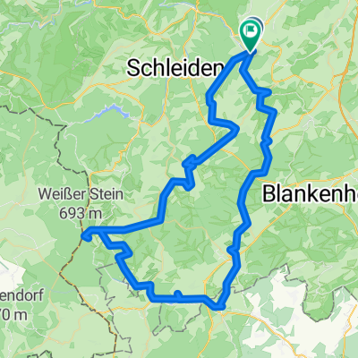
Gemünd-Talsperrenrunde-Heimbach
A cycling route starting in Kall, North Rhine-Westphalia, Germany.
Overview
About this route
from Gemünd, it goes along the Urft to the Urft Dam, then along the Rur Lake to Schwamenauel and then downhill to the Heimbach Reservoir past the power plant to Heimbach.
- -:--
- Duration
- 39.5 km
- Distance
- 399 m
- Ascent
- 679 m
- Descent
- ---
- Avg. speed
- ---
- Max. altitude
Continue with Bikemap
Use, edit, or download this cycling route
You would like to ride Gemünd-Talsperrenrunde-Heimbach or customize it for your own trip? Here is what you can do with this Bikemap route:
Free features
- Save this route as favorite or in collections
- Copy & plan your own version of this route
- Sync your route with Garmin or Wahoo
Premium features
Free trial for 3 days, or one-time payment. More about Bikemap Premium.
- Navigate this route on iOS & Android
- Export a GPX / KML file of this route
- Create your custom printout (try it for free)
- Download this route for offline navigation
Discover more Premium features.
Get Bikemap PremiumFrom our community
Other popular routes starting in Kall
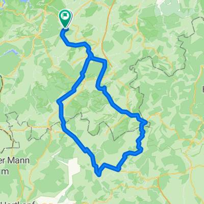
 Schneifel-Tour
- Distance
- 80.3 km
- Ascent
- 767 m
- Descent
- 768 m
- Location
- Kall, North Rhine-Westphalia, Germany
 Gemünd-Talsperrenrunde-Heimbach
- Distance
- 39.5 km
- Ascent
- 399 m
- Descent
- 679 m
- Location
- Kall, North Rhine-Westphalia, Germany
 Eifel route Gemünd
- Distance
- 87.2 km
- Ascent
- 1,079 m
- Descent
- 1,078 m
- Location
- Kall, North Rhine-Westphalia, Germany
 Lilienstraße nach Am Stellwerk
- Distance
- 103.8 km
- Ascent
- 736 m
- Descent
- 749 m
- Location
- Kall, North Rhine-Westphalia, Germany
 bonnloire
- Distance
- 1,098.5 km
- Ascent
- 4,281 m
- Descent
- 4,659 m
- Location
- Kall, North Rhine-Westphalia, Germany
 kall runde 37 km
- Distance
- 36.3 km
- Ascent
- 351 m
- Descent
- 321 m
- Location
- Kall, North Rhine-Westphalia, Germany
 Rursee Runde
- Distance
- 54.7 km
- Ascent
- 916 m
- Descent
- 921 m
- Location
- Kall, North Rhine-Westphalia, Germany
 Urftseerunde
- Distance
- 42.3 km
- Ascent
- 650 m
- Descent
- 646 m
- Location
- Kall, North Rhine-Westphalia, Germany
Open it in the app