
Route zu Gemeindeamt Kals am Großglockner
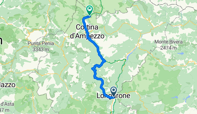
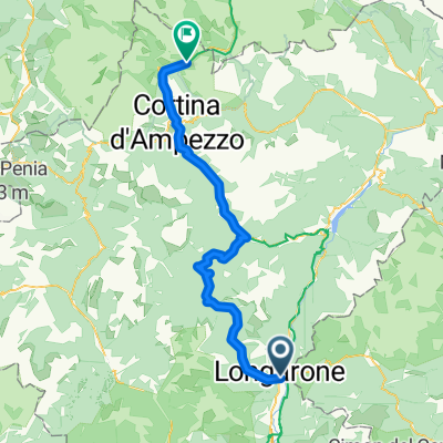
Longarone - Cortina d'Ampezzo
A cycling route starting in Longarone, Veneto, Italy.
Overview
About this route
- 4 h 39 min
- Duration
- 66.8 km
- Distance
- 2,967 m
- Ascent
- 1,929 m
- Descent
- 14.4 km/h
- Avg. speed
- 1,643 m
- Max. altitude
Part of
Route quality
Waytypes & surfaces along the route
Waytypes
Cycleway
23.4 km
(35 %)
Quiet road
16.7 km
(25 %)
Surfaces
Paved
46.1 km
(69 %)
Unpaved
10.7 km
(16 %)
Asphalt
46.1 km
(69 %)
Gravel
10.7 km
(16 %)
Undefined
10 km
(15 %)
Continue with Bikemap
Use, edit, or download this cycling route
You would like to ride Longarone - Cortina d'Ampezzo or customize it for your own trip? Here is what you can do with this Bikemap route:
Free features
- Save this route as favorite or in collections
- Copy & plan your own version of this route
- Sync your route with Garmin or Wahoo
Premium features
Free trial for 3 days, or one-time payment. More about Bikemap Premium.
- Navigate this route on iOS & Android
- Export a GPX / KML file of this route
- Create your custom printout (try it for free)
- Download this route for offline navigation
Discover more Premium features.
Get Bikemap PremiumFrom our community
Other popular routes starting in Longarone
 Passi Rest e Mauria
- Distance
- 189.2 km
- Ascent
- 2,073 m
- Descent
- 2,092 m
- Location
- Longarone, Veneto, Italy
 Via Alemagna, Longarone nach Via Luigi Bailo 2–8, Treviso
- Distance
- 92.3 km
- Ascent
- 857 m
- Descent
- 1,316 m
- Location
- Longarone, Veneto, Italy
 Longarone - Cortina d'Ampezzo
- Distance
- 66.8 km
- Ascent
- 2,967 m
- Descent
- 1,929 m
- Location
- Longarone, Veneto, Italy
 Giro del Civetta,
- Distance
- 121.1 km
- Ascent
- 2,539 m
- Descent
- 2,540 m
- Location
- Longarone, Veneto, Italy
 Val di zoldo e sellaronda
- Distance
- 180.8 km
- Ascent
- 3,456 m
- Descent
- 3,462 m
- Location
- Longarone, Veneto, Italy
 2015/07/04 Passi Rest e Mauria
- Distance
- 189.1 km
- Ascent
- 2,196 m
- Descent
- 2,193 m
- Location
- Longarone, Veneto, Italy
 Dolomiti tour
- Distance
- 206.6 km
- Ascent
- 3,327 m
- Descent
- 3,322 m
- Location
- Longarone, Veneto, Italy
 Longarone-Cavallino
- Distance
- 126.8 km
- Ascent
- 86 m
- Descent
- 559 m
- Location
- Longarone, Veneto, Italy
Open it in the app