

ch12 Niederwangen - Rosshaeusern
A cycling route starting in Köniz, Canton of Bern, Switzerland.
Overview
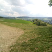
About this route
The effective elevation gain is about 100 m more than the calculation by bikemap! Short, steep climb after km 11!
- -:--
- Duration
- 22.7 km
- Distance
- 257 m
- Ascent
- 234 m
- Descent
- ---
- Avg. speed
- 646 m
- Max. altitude

Route quality
Waytypes & surfaces along the route
Waytypes
Road
10.5 km
(46 %)
Quiet road
6.6 km
(29 %)
Surfaces
Paved
5 km
(22 %)
Unpaved
6.1 km
(27 %)
Gravel
5 km
(22 %)
Asphalt
4.5 km
(20 %)
Continue with Bikemap
Use, edit, or download this cycling route
You would like to ride ch12 Niederwangen - Rosshaeusern or customize it for your own trip? Here is what you can do with this Bikemap route:
Free features
- Save this route as favorite or in collections
- Copy & plan your own version of this route
- Sync your route with Garmin or Wahoo
Premium features
Free trial for 3 days, or one-time payment. More about Bikemap Premium.
- Navigate this route on iOS & Android
- Export a GPX / KML file of this route
- Create your custom printout (try it for free)
- Download this route for offline navigation
Discover more Premium features.
Get Bikemap PremiumFrom our community
Other popular routes starting in Köniz
 032_290_Niederwangen-Süri-Neuenegg-Mittelhäusern-Schliern
- Distance
- 32.2 km
- Ascent
- 317 m
- Descent
- 309 m
- Location
- Köniz, Canton of Bern, Switzerland
 Könizwald mittel 130
- Distance
- 8.3 km
- Ascent
- 166 m
- Descent
- 164 m
- Location
- Köniz, Canton of Bern, Switzerland
 De Dorfbachstrasse 58, Köniz a Dorfbachstrasse 60, Köniz
- Distance
- 63.5 km
- Ascent
- 1,079 m
- Descent
- 1,079 m
- Location
- Köniz, Canton of Bern, Switzerland
 Retour vom Güsche
- Distance
- 9.6 km
- Ascent
- 47 m
- Descent
- 424 m
- Location
- Köniz, Canton of Bern, Switzerland
 ch12 Niederwangen - Rosshaeusern
- Distance
- 22.7 km
- Ascent
- 257 m
- Descent
- 234 m
- Location
- Köniz, Canton of Bern, Switzerland
 gurnigel-run
- Distance
- 72.6 km
- Ascent
- 1,870 m
- Descent
- 1,715 m
- Location
- Köniz, Canton of Bern, Switzerland
 Bern-Murten-Tafers-Schwarzenburg-Bern
- Distance
- 75.2 km
- Ascent
- 746 m
- Descent
- 746 m
- Location
- Köniz, Canton of Bern, Switzerland
 Tour in Bern
- Distance
- 39.6 km
- Ascent
- 555 m
- Descent
- 553 m
- Location
- Köniz, Canton of Bern, Switzerland
Open it in the app