

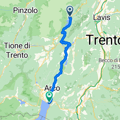
Sentiero per Lago nach Strada Regionale
A cycling route starting in Molveno, Trentino-Alto Adige, Italy.
Overview
About this route
- 2 h 49 min
- Duration
- 44.3 km
- Distance
- 885 m
- Ascent
- 1,667 m
- Descent
- 15.8 km/h
- Avg. speed
- 941 m
- Max. altitude
Route quality
Waytypes & surfaces along the route
Waytypes
Cycleway
16.8 km
(38 %)
Track
8.9 km
(20 %)
Surfaces
Paved
35.9 km
(81 %)
Unpaved
6.2 km
(14 %)
Asphalt
32.4 km
(73 %)
Gravel
4.4 km
(10 %)
Continue with Bikemap
Use, edit, or download this cycling route
You would like to ride Sentiero per Lago nach Strada Regionale or customize it for your own trip? Here is what you can do with this Bikemap route:
Free features
- Save this route as favorite or in collections
- Copy & plan your own version of this route
- Sync your route with Garmin or Wahoo
Premium features
Free trial for 3 days, or one-time payment. More about Bikemap Premium.
- Navigate this route on iOS & Android
- Export a GPX / KML file of this route
- Create your custom printout (try it for free)
- Download this route for offline navigation
Discover more Premium features.
Get Bikemap PremiumFrom our community
Other popular routes starting in Molveno
 AC T6 temp
- Distance
- 317.4 km
- Ascent
- 6,029 m
- Descent
- 7,322 m
- Location
- Molveno, Trentino-Alto Adige, Italy
 giro molveno
- Distance
- 140.4 km
- Ascent
- 2,365 m
- Descent
- 2,365 m
- Location
- Molveno, Trentino-Alto Adige, Italy
 Bear trail_Modificato
- Distance
- 46.3 km
- Ascent
- 3,030 m
- Descent
- 3,033 m
- Location
- Molveno, Trentino-Alto Adige, Italy
 Girolago
- Distance
- 20.3 km
- Ascent
- 359 m
- Descent
- 359 m
- Location
- Molveno, Trentino-Alto Adige, Italy
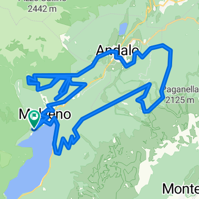
 Andalo
- Distance
- 44.7 km
- Ascent
- 1,440 m
- Descent
- 1,441 m
- Location
- Molveno, Trentino-Alto Adige, Italy
 Route nach Landeck
- Distance
- 46.2 km
- Ascent
- 1,212 m
- Descent
- 2,031 m
- Location
- Molveno, Trentino-Alto Adige, Italy
3121®
Molveno Cycling- Distance
- 41.5 km
- Ascent
- 1,931 m
- Descent
- 1,917 m
- Location
- Molveno, Trentino-Alto Adige, Italy
 Sentiero per Lago nach Strada Regionale
- Distance
- 44.3 km
- Ascent
- 885 m
- Descent
- 1,667 m
- Location
- Molveno, Trentino-Alto Adige, Italy
Open it in the app