
ㅎㅎㅎㅎㅎ
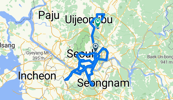
A cycling route starting in Guri-si, Gyeonggi-do, South Korea.
Overview
About this route
- 11 h 46 min
- Duration
- 229.8 km
- Distance
- 1,684 m
- Ascent
- 1,671 m
- Descent
- 19.5 km/h
- Avg. speed
- 154 m
- Max. altitude
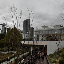
Route photos


Continue with Bikemap
Use, edit, or download this cycling route
You would like to ride ㅎㅎㅎㅎㅎ or customize it for your own trip? Here is what you can do with this Bikemap route:
Free features
- Save this route as favorite or in collections
- Copy & plan your own version of this route
- Split it into stages to create a multi-day tour
- Sync your route with Garmin or Wahoo
Premium features
Free trial for 3 days, or one-time payment. More about Bikemap Premium.
- Navigate this route on iOS & Android
- Export a GPX / KML file of this route
- Create your custom printout (try it for free)
- Download this route for offline navigation
Discover more Premium features.
Get Bikemap PremiumFrom our community
Other popular routes starting in Guri-si
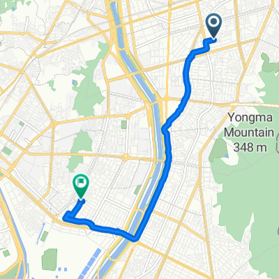
 신천동, 서울특별시에서 신천동, 서울특별시까지
- Distance
- 22.8 km
- Ascent
- 119 m
- Descent
- 123 m
- Location
- Guri-si, Gyeonggi-do, South Korea
 53-3 53-3 ~ 장안동 192-75
- Distance
- 6.4 km
- Ascent
- 59 m
- Descent
- 87 m
- Location
- Guri-si, Gyeonggi-do, South Korea
 Seoul Hangang
- Distance
- 31.2 km
- Ascent
- 91 m
- Descent
- 95 m
- Location
- Guri-si, Gyeonggi-do, South Korea
 느린 주행
느린 주행- Distance
- 16.7 km
- Ascent
- 34 m
- Descent
- 59 m
- Location
- Guri-si, Gyeonggi-do, South Korea
 공릉동 233−4 to 공릉2동 248−4
- Distance
- 43.6 km
- Ascent
- 366 m
- Descent
- 358 m
- Location
- Guri-si, Gyeonggi-do, South Korea
 10-17 10-17 ~ 대치동 1012-120
- Distance
- 20.2 km
- Ascent
- 73 m
- Descent
- 118 m
- Location
- Guri-si, Gyeonggi-do, South Korea
 구의동 546-1 ~ 물금읍 898-2, 양산시
- Distance
- 478.9 km
- Ascent
- 5,702 m
- Descent
- 5,724 m
- Location
- Guri-si, Gyeonggi-do, South Korea
 20251002서울야간라이딩
- Distance
- 26 km
- Ascent
- 138 m
- Descent
- 162 m
- Location
- Guri-si, Gyeonggi-do, South Korea
Open it in the app