
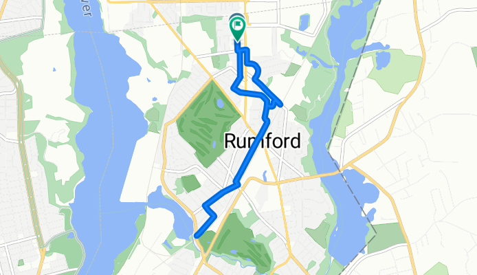
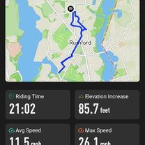
Pine Grove Street to Pine Grove Street
A cycling route starting in Pawtucket, Rhode Island, United States.
Overview
About this route
- 46 min
- Duration
- 7.4 km
- Distance
- 15 m
- Ascent
- 22 m
- Descent
- 9.6 km/h
- Avg. speed
- 4 m
- Max. altitude

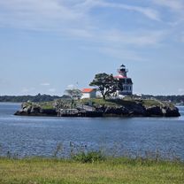
Route photos


Route quality
Waytypes & surfaces along the route
Waytypes
Quiet road
5.1 km
(69 %)
Road
1.4 km
(19 %)
Surfaces
Paved
6.8 km
(92 %)
Asphalt
6.8 km
(92 %)
Undefined
0.6 km
(8 %)
Continue with Bikemap
Use, edit, or download this cycling route
You would like to ride Pine Grove Street to Pine Grove Street or customize it for your own trip? Here is what you can do with this Bikemap route:
Free features
- Save this route as favorite or in collections
- Copy & plan your own version of this route
- Sync your route with Garmin or Wahoo
Premium features
Free trial for 3 days, or one-time payment. More about Bikemap Premium.
- Navigate this route on iOS & Android
- Export a GPX / KML file of this route
- Create your custom printout (try it for free)
- Download this route for offline navigation
Discover more Premium features.
Get Bikemap PremiumFrom our community
Other popular routes starting in Pawtucket
 Seekonk-Rehoboth-Attleboro Loop
- Distance
- 62.7 km
- Ascent
- 154 m
- Descent
- 134 m
- Location
- Pawtucket, Rhode Island, United States
 Tour of Rhode Island
- Distance
- 96.1 km
- Ascent
- 187 m
- Descent
- 187 m
- Location
- Pawtucket, Rhode Island, United States
 Pawt-No Seekonk-Rehoboth-Attleboro-Cumb-CF
- Distance
- 34.9 km
- Ascent
- 77 m
- Descent
- 69 m
- Location
- Pawtucket, Rhode Island, United States
 31 Sheffield Ave, Pawtucket to 1 Burlingame State Park Rd, Charlestown
- Distance
- 70.2 km
- Ascent
- 879 m
- Descent
- 884 m
- Location
- Pawtucket, Rhode Island, United States
 Pine Grove Street to Pine Grove Street
- Distance
- 7.4 km
- Ascent
- 15 m
- Descent
- 22 m
- Location
- Pawtucket, Rhode Island, United States
 Pawt to Sustainability Festival
- Distance
- 44.8 km
- Ascent
- 177 m
- Descent
- 128 m
- Location
- Pawtucket, Rhode Island, United States
 Fern Drive to Fern Drive
- Distance
- 34 km
- Ascent
- 157 m
- Descent
- 147 m
- Location
- Pawtucket, Rhode Island, United States
 New Western Route - Wrong Turn
- Distance
- 36.1 km
- Ascent
- 191 m
- Descent
- 191 m
- Location
- Pawtucket, Rhode Island, United States
Open it in the app