
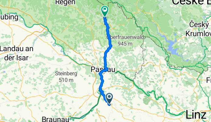
Ranseredt,nach Lusenstraße, Neuschönau
A cycling route starting in Sankt Marienkirchen bei Schärding, Upper Austria, Austria.
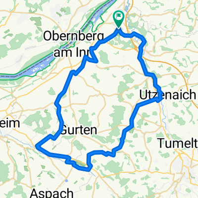
Overview
About this route
- 5 h
- Duration
- 76.1 km
- Distance
- 1,495 m
- Ascent
- 1,094 m
- Descent
- 15.2 km/h
- Avg. speed
- 803 m
- Max. altitude

Route quality
Waytypes & surfaces along the route
Waytypes
Quiet road
44.1 km
(58 %)
Cycleway
15.2 km
(20 %)
Surfaces
Paved
41.9 km
(55 %)
Unpaved
11.4 km
(15 %)
Asphalt
36.5 km
(48 %)
Paved (undefined)
5.3 km
(7 %)
Continue with Bikemap
Use, edit, or download this cycling route
You would like to ride Ranseredt,nach Lusenstraße, Neuschönau or customize it for your own trip? Here is what you can do with this Bikemap route:
Free features
- Save this route as favorite or in collections
- Copy & plan your own version of this route
- Sync your route with Garmin or Wahoo
Premium features
Free trial for 3 days, or one-time payment. More about Bikemap Premium.
- Navigate this route on iOS & Android
- Export a GPX / KML file of this route
- Create your custom printout (try it for free)
- Download this route for offline navigation
Discover more Premium features.
Get Bikemap PremiumFrom our community
Other popular routes starting in Sankt Marienkirchen bei Schärding
 Von Eggerding bis Eitzing
- Distance
- 27.5 km
- Ascent
- 458 m
- Descent
- 366 m
- Location
- Sankt Marienkirchen bei Schärding, Upper Austria, Austria
 Ort-Obernberg-Schärding-Teufenbach-Ort
- Distance
- 56.2 km
- Ascent
- 267 m
- Descent
- 264 m
- Location
- Sankt Marienkirchen bei Schärding, Upper Austria, Austria
 Würding Aigen am Inn
- Distance
- 41.3 km
- Ascent
- 68 m
- Descent
- 68 m
- Location
- Sankt Marienkirchen bei Schärding, Upper Austria, Austria
 Ranseredt,nach Lusenstraße, Neuschönau
- Distance
- 82.2 km
- Ascent
- 1,838 m
- Descent
- 1,094 m
- Location
- Sankt Marienkirchen bei Schärding, Upper Austria, Austria
 Von Eggerding bis Ulrichsberg
- Distance
- 82.4 km
- Ascent
- 1,250 m
- Descent
- 995 m
- Location
- Sankt Marienkirchen bei Schärding, Upper Austria, Austria
 ¿øtˇ? nach ¿øtˇ?
- Distance
- 30.2 km
- Ascent
- 509 m
- Descent
- 505 m
- Location
- Sankt Marienkirchen bei Schärding, Upper Austria, Austria
 Münsteuer_St.Georgen b.Obernb._Polling_Kirchheim i.Innk._St.Martin_Ort_Münsteuer
- Distance
- 50.6 km
- Ascent
- 260 m
- Descent
- 261 m
- Location
- Sankt Marienkirchen bei Schärding, Upper Austria, Austria
 H 24, 4774 - Schardenberg - H 24
- Distance
- 47.1 km
- Ascent
- 585 m
- Descent
- 565 m
- Location
- Sankt Marienkirchen bei Schärding, Upper Austria, Austria
Open it in the app