

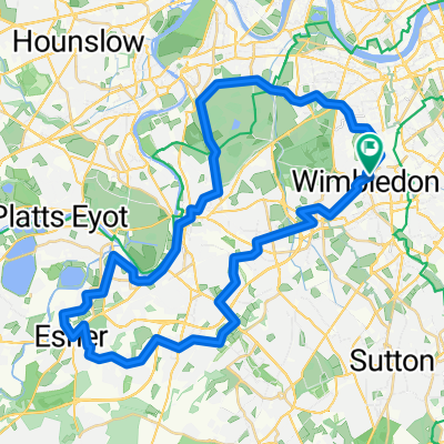
London to Aylesbury
A cycling route starting in Earlsfield, England, United Kingdom.
Overview
About this route
Haven't done this route yet, so fingers crossed.
- -:--
- Duration
- 74.4 km
- Distance
- 335 m
- Ascent
- 274 m
- Descent
- ---
- Avg. speed
- ---
- Max. altitude

Continue with Bikemap
Use, edit, or download this cycling route
You would like to ride London to Aylesbury or customize it for your own trip? Here is what you can do with this Bikemap route:
Free features
- Save this route as favorite or in collections
- Copy & plan your own version of this route
- Sync your route with Garmin or Wahoo
Premium features
Free trial for 3 days, or one-time payment. More about Bikemap Premium.
- Navigate this route on iOS & Android
- Export a GPX / KML file of this route
- Create your custom printout (try it for free)
- Download this route for offline navigation
Discover more Premium features.
Get Bikemap PremiumFrom our community
Other popular routes starting in Earlsfield
 Parkwood Road, London to Parkwood Road, London
- Distance
- 46.4 km
- Ascent
- 253 m
- Descent
- 252 m
- Location
- Earlsfield, England, United Kingdom
 Tooting - White City
- Distance
- 10.8 km
- Ascent
- 7 m
- Descent
- 30 m
- Location
- Earlsfield, England, United Kingdom
 Wimbledon Park to Soho
- Distance
- 12.3 km
- Ascent
- 48 m
- Descent
- 26 m
- Location
- Earlsfield, England, United Kingdom
 Trinity Road, London to Chumleigh Street, London
- Distance
- 14.1 km
- Ascent
- 63 m
- Descent
- 80 m
- Location
- Earlsfield, England, United Kingdom
 London to Aylesbury
- Distance
- 74.4 km
- Ascent
- 335 m
- Descent
- 274 m
- Location
- Earlsfield, England, United Kingdom
 Richmond Park-Windsor and back
- Distance
- 115.3 km
- Ascent
- 175 m
- Descent
- 175 m
- Location
- Earlsfield, England, United Kingdom
 Tooting to Faversham
- Distance
- 174.3 km
- Ascent
- 664 m
- Descent
- 671 m
- Location
- Earlsfield, England, United Kingdom
 ride to college
- Distance
- 5.9 km
- Ascent
- 13 m
- Descent
- 14 m
- Location
- Earlsfield, England, United Kingdom
Open it in the app