
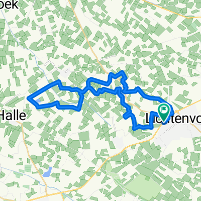
Route in Lichtenvoorde
A cycling route starting in Lichtenvoorde, Gelderland, The Netherlands.
Overview
About this route
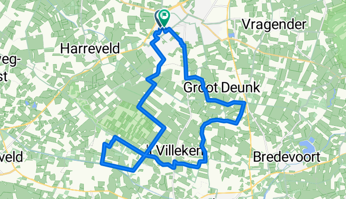
L 'Fietsvierdaagse Richting Aaltens Goor
- 1 h 30 min
- Duration
- 22.2 km
- Distance
- 26 m
- Ascent
- 27 m
- Descent
- 14.8 km/h
- Avg. speed
- 35 m
- Max. altitude

Route quality
Waytypes & surfaces along the route
Waytypes
Quiet road
18.2 km
(82 %)
Road
1.3 km
(6 %)
Surfaces
Paved
11.5 km
(52 %)
Unpaved
1.8 km
(8 %)
Asphalt
11.3 km
(51 %)
Gravel
1.1 km
(5 %)
Continue with Bikemap
Use, edit, or download this cycling route
You would like to ride Route in Lichtenvoorde or customize it for your own trip? Here is what you can do with this Bikemap route:
Free features
- Save this route as favorite or in collections
- Copy & plan your own version of this route
- Sync your route with Garmin or Wahoo
Premium features
Free trial for 3 days, or one-time payment. More about Bikemap Premium.
- Navigate this route on iOS & Android
- Export a GPX / KML file of this route
- Create your custom printout (try it for free)
- Download this route for offline navigation
Discover more Premium features.
Get Bikemap PremiumFrom our community
Other popular routes starting in Lichtenvoorde
 Oude Winterswijkseweg nach Oude Winterswijkseweg
- Distance
- 25.2 km
- Ascent
- 181 m
- Descent
- 184 m
- Location
- Lichtenvoorde, Gelderland, The Netherlands
 Beethovenstraat naar Maarsevonder
- Distance
- 10.4 km
- Ascent
- 7 m
- Descent
- 3 m
- Location
- Lichtenvoorde, Gelderland, The Netherlands
 Veldtourtocht_Lichtenvoorde
- Distance
- 50 km
- Ascent
- 73 m
- Descent
- 74 m
- Location
- Lichtenvoorde, Gelderland, The Netherlands
 Route in Lichtenvoorde
- Distance
- 22.2 km
- Ascent
- 26 m
- Descent
- 27 m
- Location
- Lichtenvoorde, Gelderland, The Netherlands
 Lichtenvoorde - Bekkendelle
- Distance
- 30.4 km
- Ascent
- 52 m
- Descent
- 52 m
- Location
- Lichtenvoorde, Gelderland, The Netherlands
 71_2020_Mariënvelde_en_omgeving
- Distance
- 43.1 km
- Ascent
- 71 m
- Descent
- 70 m
- Location
- Lichtenvoorde, Gelderland, The Netherlands
 From Vragender to Arnhem
- Distance
- 68.4 km
- Ascent
- 78 m
- Descent
- 74 m
- Location
- Lichtenvoorde, Gelderland, The Netherlands
 Route in Lichtenvoorde
- Distance
- 26.7 km
- Ascent
- 3 m
- Descent
- 4 m
- Location
- Lichtenvoorde, Gelderland, The Netherlands
Open it in the app