
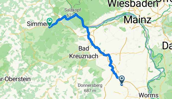
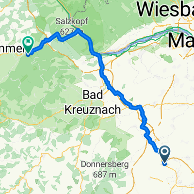
Weedegasse nach Soonwaldstraße
A cycling route starting in Ober-Flörsheim, Rhineland-Palatinate, Germany.
Overview
About this route
- 5 h 13 min
- Duration
- 81.7 km
- Distance
- 1,067 m
- Ascent
- 848 m
- Descent
- 15.7 km/h
- Avg. speed
- 493 m
- Max. altitude

Route quality
Waytypes & surfaces along the route
Waytypes
Track
39.2 km
(48 %)
Quiet road
15.5 km
(19 %)
Surfaces
Paved
63.7 km
(78 %)
Unpaved
3.3 km
(4 %)
Asphalt
51.5 km
(63 %)
Paved (undefined)
6.5 km
(8 %)
Continue with Bikemap
Use, edit, or download this cycling route
You would like to ride Weedegasse nach Soonwaldstraße or customize it for your own trip? Here is what you can do with this Bikemap route:
Free features
- Save this route as favorite or in collections
- Copy & plan your own version of this route
- Split it into stages to create a multi-day tour
- Sync your route with Garmin or Wahoo
Premium features
Free trial for 3 days, or one-time payment. More about Bikemap Premium.
- Navigate this route on iOS & Android
- Export a GPX / KML file of this route
- Create your custom printout (try it for free)
- Download this route for offline navigation
Discover more Premium features.
Get Bikemap PremiumFrom our community
Other popular routes starting in Ober-Flörsheim
 Route von Außerhalb 10, Ober-Flörsheim
- Distance
- 21.7 km
- Ascent
- 578 m
- Descent
- 652 m
- Location
- Ober-Flörsheim, Rhineland-Palatinate, Germany
 Grundlage
- Distance
- 61.2 km
- Ascent
- 550 m
- Descent
- 584 m
- Location
- Ober-Flörsheim, Rhineland-Palatinate, Germany
 KIBO
KIBO- Distance
- 25.4 km
- Ascent
- 213 m
- Descent
- 213 m
- Location
- Ober-Flörsheim, Rhineland-Palatinate, Germany
 Weedegasse nach Soonwaldstraße
- Distance
- 81.7 km
- Ascent
- 1,067 m
- Descent
- 848 m
- Location
- Ober-Flörsheim, Rhineland-Palatinate, Germany
 Alzeyer Straße 72, Ober-Flörsheim nach Hüttenstraße 33 A, Worms
- Distance
- 22.1 km
- Ascent
- 41 m
- Descent
- 209 m
- Location
- Ober-Flörsheim, Rhineland-Palatinate, Germany
 Ober-Flörsheim -> Mainz
- Distance
- 46.1 km
- Ascent
- 245 m
- Descent
- 397 m
- Location
- Ober-Flörsheim, Rhineland-Palatinate, Germany
 Walterplatz nach Speckerbrücke
- Distance
- 43.1 km
- Ascent
- 518 m
- Descent
- 657 m
- Location
- Ober-Flörsheim, Rhineland-Palatinate, Germany
 Kirschgartenstraße 10A, Ober-Flörsheim nach Am Schlosspark 14, Alzey
- Distance
- 11.6 km
- Ascent
- 87 m
- Descent
- 169 m
- Location
- Ober-Flörsheim, Rhineland-Palatinate, Germany
Open it in the app