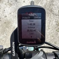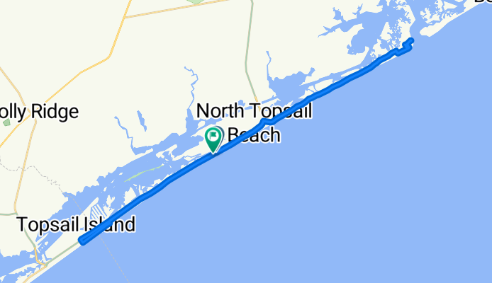


Spicer Lake Dr, Holly Ridge to 220 Spicer Lake Dr, Holly Ridge
- 16.4 km
- 3 m
- 10 m
- Holly Ridge, North Carolina, United States
A cycling route starting in Holly Ridge, North Carolina, United States.
Overview
created this 3 months ago

Route quality
Quiet road
24.8 km
(60 %)
Access road
0.4 km
(1 %)
Undefined
16.2 km
(39 %)
Paved
3.3 km
(8 %)
Asphalt
3.3 km
(8 %)
Undefined
38.1 km
(92 %)
Continue with Bikemap
You would like to ride North Topsail-Surf City or customize it for your own trip? Here is what you can do with this Bikemap route:
Free trial for 3 days, or one-time payment. More about Bikemap Premium.
Discover more Premium features.
Get Bikemap PremiumFrom our community
Open it in the app