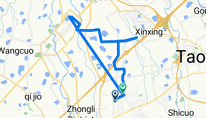
輕鬆騎行 中壢區
A cycling route starting in Taoyuan, Taiwan, Taiwan.
Overview
About this route
- 3 h 5 min
- Duration
- 16.9 km
- Distance
- 76 m
- Ascent
- 82 m
- Descent
- 5.5 km/h
- Avg. speed
- 124 m
- Max. altitude
Route quality
Waytypes & surfaces along the route
Waytypes
Quiet road
6.4 km
(38 %)
Road
5.6 km
(33 %)
Surfaces
Paved
7.5 km
(44 %)
Asphalt
5.3 km
(31 %)
Paved (undefined)
2.2 km
(13 %)
Undefined
9.5 km
(56 %)
Continue with Bikemap
Use, edit, or download this cycling route
You would like to ride 輕鬆騎行 中壢區 or customize it for your own trip? Here is what you can do with this Bikemap route:
Free features
- Save this route as favorite or in collections
- Copy & plan your own version of this route
- Sync your route with Garmin or Wahoo
Premium features
Free trial for 3 days, or one-time payment. More about Bikemap Premium.
- Navigate this route on iOS & Android
- Export a GPX / KML file of this route
- Create your custom printout (try it for free)
- Download this route for offline navigation
Discover more Premium features.
Get Bikemap PremiumFrom our community
Other popular routes starting in Taoyuan
Home to stone door reservoir- Distance
- 42.3 km
- Ascent
- 501 m
- Descent
- 357 m
- Location
- Taoyuan, Taiwan, Taiwan
林口虎頭山- Distance
- 32.5 km
- Ascent
- 267 m
- Descent
- 258 m
- Location
- Taoyuan, Taiwan, Taiwan
同安街桃園區 to 竹圍漁港大園區to同安街桃園區- Distance
- 41.1 km
- Ascent
- 164 m
- Descent
- 155 m
- Location
- Taoyuan, Taiwan, Taiwan
Tong'an St, Taoyuan District to Tong'an St Ln 291, Taoyuan District- Distance
- 25.1 km
- Ascent
- 373 m
- Descent
- 373 m
- Location
- Taoyuan, Taiwan, Taiwan
輕鬆騎行 中壢區- Distance
- 16.9 km
- Ascent
- 76 m
- Descent
- 82 m
- Location
- Taoyuan, Taiwan, Taiwan
同安街桃園區 to 赤塗路蘆竹區to陳厝坑路601巷龜山區to同安街桃園區- Distance
- 32.2 km
- Ascent
- 326 m
- Descent
- 325 m
- Location
- Taoyuan, Taiwan, Taiwan
Kengguo Rd, Luzhu District to Nankan Rd Sec 1, Luzhu District- Distance
- 21.6 km
- Ascent
- 115 m
- Descent
- 88 m
- Location
- Taoyuan, Taiwan, Taiwan
圳佳路 1之3號 to 忠孝西路182巷 3號三樓之1- Distance
- 28.9 km
- Ascent
- 315 m
- Descent
- 348 m
- Location
- Taoyuan, Taiwan, Taiwan
Open it in the app


