
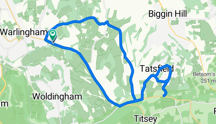
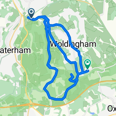
loop with tatesfield
A cycling route starting in Warlingham, England, United Kingdom.
Overview
About this route
- 1 h 12 min
- Duration
- 19.9 km
- Distance
- 265 m
- Ascent
- 266 m
- Descent
- 16.6 km/h
- Avg. speed
- 263 m
- Max. altitude

Route quality
Waytypes & surfaces along the route
Waytypes
Road
7.2 km
(36 %)
Quiet road
6.4 km
(32 %)
Surfaces
Paved
12.1 km
(61 %)
Unpaved
0.4 km
(2 %)
Asphalt
12.1 km
(61 %)
Gravel
0.4 km
(2 %)
Undefined
7.4 km
(37 %)
Continue with Bikemap
Use, edit, or download this cycling route
You would like to ride loop with tatesfield or customize it for your own trip? Here is what you can do with this Bikemap route:
Free features
- Save this route as favorite or in collections
- Copy & plan your own version of this route
- Sync your route with Garmin or Wahoo
Premium features
Free trial for 3 days, or one-time payment. More about Bikemap Premium.
- Navigate this route on iOS & Android
- Export a GPX / KML file of this route
- Create your custom printout (try it for free)
- Download this route for offline navigation
Discover more Premium features.
Get Bikemap PremiumFrom our community
Other popular routes starting in Warlingham
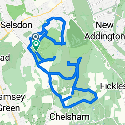 Selsdon to Farleigh
- Distance
- 20.8 km
- Ascent
- 266 m
- Descent
- 266 m
- Location
- Warlingham, England, United Kingdom
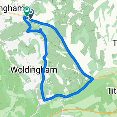
 B269 to Limpsfield Road
- Distance
- 13.7 km
- Ascent
- 189 m
- Descent
- 191 m
- Location
- Warlingham, England, United Kingdom
 Kingsmead Equestrian Centre, Kingswood Lane, Warlingham to 8 Cullesden Road, Kenley
- Distance
- 23.4 km
- Ascent
- 294 m
- Descent
- 323 m
- Location
- Warlingham, England, United Kingdom
 B269 to B269
- Distance
- 12.2 km
- Ascent
- 188 m
- Descent
- 242 m
- Location
- Warlingham, England, United Kingdom
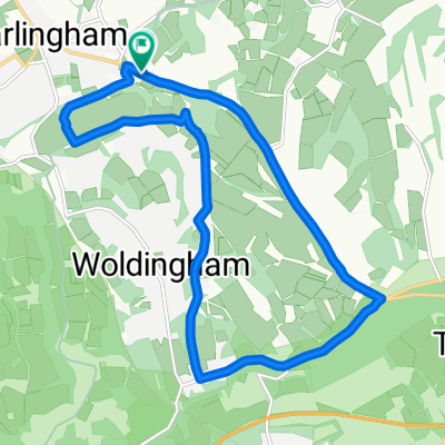
 Route in Warlingham
- Distance
- 20.5 km
- Ascent
- 422 m
- Descent
- 278 m
- Location
- Warlingham, England, United Kingdom
 knights via sainsburys
- Distance
- 13 km
- Ascent
- 153 m
- Descent
- 155 m
- Location
- Warlingham, England, United Kingdom
 Limpsfield Road, Warlingham to Spring Park, Woodland Way, West Wickham
- Distance
- 13.7 km
- Ascent
- 88 m
- Descent
- 174 m
- Location
- Warlingham, England, United Kingdom
 Biggin Hill to North Greenwich Foot Tunnel
- Distance
- 26.7 km
- Ascent
- 100 m
- Descent
- 281 m
- Location
- Warlingham, England, United Kingdom
Open it in the app