
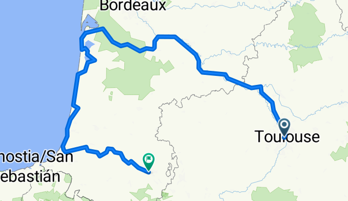
From Toulouse to Saint-Martin-de-Seignanx
A cycling route starting in Blagnac, Occitanie, France.
Overview
About this route
- 34 h 23 min
- Duration
- 631.7 km
- Distance
- 3,336 m
- Ascent
- 3,285 m
- Descent
- 18.4 km/h
- Avg. speed
- 202 m
- Max. altitude

Route quality
Waytypes & surfaces along the route
Waytypes
Cycleway
435.9 km
(69 %)
Quiet road
69.5 km
(11 %)
Surfaces
Paved
543.3 km
(86 %)
Unpaved
12.6 km
(2 %)
Asphalt
461.2 km
(73 %)
Paved (undefined)
82.1 km
(13 %)
Continue with Bikemap
Use, edit, or download this cycling route
You would like to ride From Toulouse to Saint-Martin-de-Seignanx or customize it for your own trip? Here is what you can do with this Bikemap route:
Free features
- Save this route as favorite or in collections
- Copy & plan your own version of this route
- Split it into stages to create a multi-day tour
- Sync your route with Garmin or Wahoo
Premium features
Free trial for 3 days, or one-time payment. More about Bikemap Premium.
- Navigate this route on iOS & Android
- Export a GPX / KML file of this route
- Create your custom printout (try it for free)
- Download this route for offline navigation
Discover more Premium features.
Get Bikemap PremiumFrom our community
Other popular routes starting in Blagnac
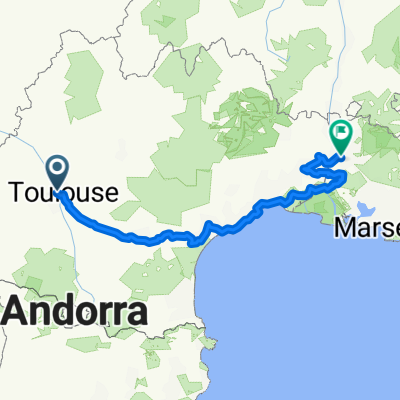
 TLS-Atlantik-Pyrenäen
- Distance
- 963.2 km
- Ascent
- 2,732 m
- Descent
- 2,728 m
- Location
- Blagnac, Occitanie, France
 Тулуза-Авиньон
- Distance
- 516 km
- Ascent
- 390 m
- Descent
- 524 m
- Location
- Blagnac, Occitanie, France
 GARO-BOUCO-SARTHA-25
- Distance
- 66.6 km
- Ascent
- 275 m
- Descent
- 273 m
- Location
- Blagnac, Occitanie, France
 France et Alpes - Juillet 2013 - trajet fait
- Distance
- 981.7 km
- Ascent
- 3,618 m
- Descent
- 3,531 m
- Location
- Blagnac, Occitanie, France
 Canal del Midi
- Distance
- 243.2 km
- Ascent
- 644 m
- Descent
- 789 m
- Location
- Blagnac, Occitanie, France
 dojazd z Tuluzy do Quarante
- Distance
- 637.7 km
- Ascent
- 3,278 m
- Descent
- 3,312 m
- Location
- Blagnac, Occitanie, France
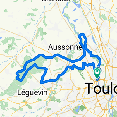
 Tr 105 km
- Distance
- 105 km
- Ascent
- 201 m
- Descent
- 199 m
- Location
- Blagnac, Occitanie, France
 VUELTA
- Distance
- 71.2 km
- Ascent
- 423 m
- Descent
- 422 m
- Location
- Blagnac, Occitanie, France
Open it in the app